Horssen geodata
Horssen (Gelderland) is a populated place; located in Netherlands in Europe/Amsterdam (GMT+2) time zone. With population of 1,095 people, there are 1338 cities with bigger population in this country. Compared to other cities in Netherlands, 60.9% of cities are located further ↑North; 52.2% of cities are located further →East and 52.4% of cities have lower elevation than Horssen. Note1


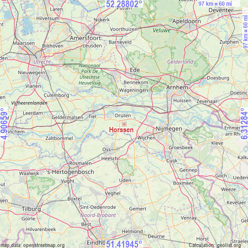
Horssen GPS coordinates[2]
51° 51' 20.988" North, 5° 36' 34.992" East
| Map corner | latitude | longitude |
|---|---|---|
| Upper-left | 52.28802°, | 4.90659° |
| Center: | 51.85583°, | 5.60972° |
| Lower-right: | 51.41945°, | 6.31284° |
| Map W x H: | 96.6×96.6 km | = 60×60mi |
| max Lat: | 53.48025° ⇑60.9% North |
| Horssen: | 51.85583° |
| min Lat: | ⇓39.1% South 50.76917° |
| min Long | Horssen | max Long |
| 3.38611° | 5.60972° | 7.16528° |
| W 47.8%⇐ | ⇒52.2% E |
Elevation
Elevation of Horssen is 7 m = 23 ft, and this is 8 m = 26 ft below average elevation for this country.
| Max E: |
203 m = 666 ft | 47.6% |
| Avg. | 15 m = 49 ft | |
| Horssen | 7 m = 23 ft | |
Min E: |
-6 m = -20 ft | 52.4% |
See also: Netherlands elevation on elevation.city.
Geographical zone
Horssen is located in North temperate zone (between Tropic of Cancer and the Arctic Circle). Distance of this North polar circle is 1635.3 km =1016.1 mi to North.| Distance of | km | miles | from Horssen |
|---|---|---|---|
| North Pole | 4241.2 | 2635.4 | to North |
| Arctic Circle | 1635.3 | 1016.1 | to North |
| Tropic Cancer | 3159.9 | 1963.5 | to South |
| Equator | 5765.8 | 3582.7 | to South |


Nearby cities:
15 places around Horssen: (largest is in red/bold)
• Afferden
3.2 km =2 mi,  32°
32°
• Batenburg
3.8 km =2.4 mi,  159°
159°
• Bergharen
4.1 km =2.5 mi,  97°
97°
• Deest
5.5 km =3.4 mi,  45°
45°
• Druten
3.6 km =2.2 mi,  355°
355°
• Haren
6.3 km =3.9 mi,  195°
195°
• Hernen
5.4 km =3.4 mi,  116°
116°
• IJzendoorn
7.6 km =4.7 mi,  316°
316°
• Macharen
7.1 km =4.4 mi,  218°
218°
• Megen
5 km =3.1 mi, 220°
• Ochten
6.6 km =4.1 mi,  335°
335°
• Oijen
8.1 km =5 mi,  244°
244°
• Opheusden
8.6 km =5.3 mi,  10°
10°
• Puiflijk
2.8 km =1.7 mi,  331°
331°
• Ravenstein
7.1 km =4.4 mi, 157°
Sources, notices
• [Note1] Compared only with cities in Netherlands existing in our database
• [Src1] Map data: © OpenStreetMap contributors (CC-BY-SA)
• [Src2] Other city data from geonames.org with taken over terms of usage.
• [Src3] Geographical zone / Annual Mean Temperature by Robert A. Rohde @ Wikipedia
