Hoogblokland geodata
Hoogblokland (South Holland) is a populated place; located in Netherlands in Europe/Amsterdam (GMT+2) time zone. With population of 1,090 people, there are 1343 cities with bigger population in this country. Compared to other cities in Netherlands, 60% of cities are located further ↑North; 74% of cities are located further →East and 96.1% of cities have higher elevation than Hoogblokland. Note1


Hoogblokland GPS coordinates[2]
51° 52' 30" North, 4° 58' 35.004" East
| Map corner | latitude | longitude |
|---|---|---|
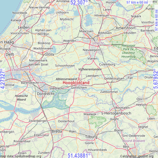
| Upper-left | 52.307°, | 4.27327° |
| Center: | 51.875°, | 4.97639° |
| Lower-right: | 51.43881°, | 5.67952° |
| Map W x H: | 96.5×96.5 km | = 60×60mi |
| max Lat: | 53.48025° ⇑60% North |
| Hoogblokland: | 51.875° |
| min Lat: | ⇓40% South 50.76917° |
| min Long | Hoogblokland | max Long |
| 3.38611° | 4.97639° | 7.16528° |
| W 26%⇐ | ⇒74% E |
Elevation
Elevation of Hoogblokland is -1 m = -3 ft, and this is 16 m = 52 ft below average elevation for this country.
| Max E: |
203 m = 666 ft | 96.1% |
| Avg. | 15 m = 49 ft | |
| Hoogblokland | -1 m = -3 ft | |
Min E: |
-6 m = -20 ft | 3.9% |
See also: Netherlands elevation on elevation.city.
Geographical zone
Hoogblokland is located in North temperate zone (between Tropic of Cancer and the Arctic Circle). Distance of this North polar circle is 1633.2 km =1014.8 mi to North.| Distance of | km | miles | from Hoogblokland |
|---|---|---|---|
| North Pole | 4239.1 | 2634.1 | to North |
| Arctic Circle | 1633.2 | 1014.8 | to North |
| Tropic Cancer | 3162 | 1964.8 | to South |
| Equator | 5768 | 3584.1 | to South |


Nearby cities:
15 places around Hoogblokland: (largest is in red/bold)
• Arkel
1.7 km =1.1 mi,  134°
134°
• Boven-Hardinxveld
8.7 km =5.4 mi,  228°
228°
• Dalem
5.8 km =3.6 mi,  156°
156°
• Giessenburg
6.5 km =4 mi,  245°
245°
• Gorinchem
4.3 km =2.7 mi,  183°
183°
• Kedichem
5.3 km =3.3 mi,  108°
108°
• Leerdam
8.2 km =5.1 mi,  75°
75°
• Neder-Hardinxveld
9.8 km =6.1 mi,  238°
238°
• Nieuwpoort
10 km =6.2 mi,  312°
312°
• Noordeloos
3.9 km =2.4 mi,  322°
322°
• Rijswijk
9.2 km =5.7 mi, 158°
• Schelluinen
4.9 km =3 mi,  224°
224°
• Vuren
7.3 km =4.5 mi,  139°
139°
• Werkendam
9.2 km =5.7 mi, 217°
• Woudrichem
6.9 km =4.3 mi,  165°
165°
Sources, notices
• [Note1] Compared only with cities in Netherlands existing in our database
• [Src1] Map data: © OpenStreetMap contributors (CC-BY-SA)
• [Src2] Other city data from geonames.org with taken over terms of usage.
• [Src3] Geographical zone / Annual Mean Temperature by Robert A. Rohde @ Wikipedia
