Haamstede geodata
Haamstede (Zeeland) is a populated place; located in Netherlands in Europe/Amsterdam (GMT+2) time zone. With population of 1,885 people, there are 1000 cities with bigger population in this country. Compared to other cities in Netherlands, 69% of cities are located further ↑North; 98% of cities are located further →East and 58.8% of cities have higher elevation than Haamstede. Note1


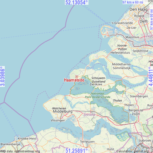
Haamstede GPS coordinates[2]
51° 41' 48.552" North, 3° 44' 34.764" East
| Map corner | latitude | longitude |
|---|---|---|
| Upper-left | 52.13054°, | 3.03986° |
| Center: | 51.69682°, | 3.74299° |
| Lower-right: | 51.25891°, | 4.44611° |
| Map W x H: | 96.9×96.9 km | = 60.2×60.2mi |
| max Lat: | 53.48025° ⇑69% North |
| Haamstede: | 51.69682° |
| min Lat: | ⇓31% South 50.76917° |
| min Long | Haamstede | max Long |
| 3.38611° | 3.74299° | 7.16528° |
| W 2%⇐ | ⇒98% E |
Elevation
Elevation of Haamstede is 4 m = 13 ft, and this is 11 m = 36 ft below average elevation for this country.
| Max E: |
203 m = 666 ft | 58.8% |
| Avg. | 15 m = 49 ft | |
| Haamstede | 4 m = 13 ft | |
Min E: |
-6 m = -20 ft | 41.2% |
See also: Netherlands elevation on elevation.city.
Geographical zone
Haamstede is located in North temperate zone (between Tropic of Cancer and the Arctic Circle). Distance of this North polar circle is 1653 km =1027.1 mi to North.| Distance of | km | miles | from Haamstede |
|---|---|---|---|
| North Pole | 4258.9 | 2646.4 | to North |
| Arctic Circle | 1653 | 1027.1 | to North |
| Tropic Cancer | 3142.2 | 1952.5 | to South |
| Equator | 5748.1 | 3571.7 | to South |


Nearby cities:
15 places around Haamstede: (largest is in red/bold)
• Brouwershaven
12.1 km =7.5 mi,  74°
74°
• Burgh
1.1 km =0.7 mi,  218°
218°
• Colijnsplaat
13.1 km =8.1 mi,  146°
146°
• Dreischor
16.6 km =10.3 mi,  92°
92°
• Kamperland
14.2 km =8.8 mi,  190°
190°
• Kerkwerve
10.8 km =6.7 mi,  96°
96°
• Malta
14.1 km =8.8 mi,  111°
111°
• Ouddorp
18.4 km =11.4 mi,  45°
45°
• Renesse
4.5 km =2.8 mi,  29°
29°
• Scharendijke
8.1 km =5 mi,  57°
57°
• Vrouwenpolder
16 km =9.9 mi,  213°
213°
• Wissenkerke
12.4 km =7.7 mi,  178°
178°
• Zanddijk
18.4 km =11.4 mi,  198°
198°
• Zierikzee
13.2 km =8.2 mi, 113°
• Zonnemaire
14.5 km =9 mi,  82°
82°
Sources, notices
• [Note1] Compared only with cities in Netherlands existing in our database
• [Src1] Map data: © OpenStreetMap contributors (CC-BY-SA)
• [Src2] Other city data from geonames.org with taken over terms of usage.
• [Src3] Geographical zone / Annual Mean Temperature by Robert A. Rohde @ Wikipedia
