Enschede geodata
Enschede (Overijssel) is a populated place; located in Netherlands in Europe/Amsterdam (GMT+2) time zone. With population of 153,655 people, there are 10 cities with bigger population in this country. Compared to other cities in Netherlands, 62% of cities are located further ↓South; 97% of cities are located further ←West and 92.7% of cities have lower elevation than Enschede. Note1


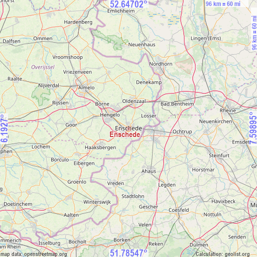
Enschede GPS coordinates[2]
52° 13' 5.988" North, 6° 53' 44.988" East
| Map corner | latitude | longitude |
|---|---|---|
| Upper-left | 52.64702°, | 6.1927° |
| Center: | 52.21833°, | 6.89583° |
| Lower-right: | 51.78547°, | 7.59895° |
| Map W x H: | 95.8×95.8 km | = 59.5×59.5mi |
| max Lat: | 53.48025° ⇑38% North |
| Enschede: | 52.21833° |
| min Lat: | ⇓62% South 50.76917° |
| min Long | Enschede | max Long |
| 3.38611° | 6.89583° | 7.16528° |
| W 97%⇐ | ⇒3% E |
Elevation
Elevation of Enschede is 45 m = 148 ft, and this is 30 m = 98 ft above average elevation for this country.
| Max E: |
203 m = 666 ft | 7.3% |
| Enschede | 45 m 148 ft | |
| Avg. | 15 m = 49 ft | |
Min E: |
-6 m = -20 ft | 92.7% |
See also: Enschede elevation on elevation.city.
Geographical zone
Enschede is located in North temperate zone (between Tropic of Cancer and the Arctic Circle). Distance of this North polar circle is 1595 km =991.1 mi to North.| Distance of | km | miles | from Enschede |
|---|---|---|---|
| North Pole | 4200.9 | 2610.3 | to North |
| Arctic Circle | 1595 | 991.1 | to North |
| Tropic Cancer | 3200.2 | 1988.5 | to South |
| Equator | 5806.1 | 3607.7 | to South |


Nearby cities:
15 places around Enschede: (largest is in red/bold)
• Borne
13.6 km =8.5 mi,  312°
312°
• Delden
13.4 km =8.3 mi,  290°
290°
• Dolphia
3.4 km =2.1 mi,  88°
88°
• Haaksbergen
12.7 km =7.9 mi,  237°
237°
• Hengelo
8.8 km =5.5 mi, 307°
• Klein Driene
7.9 km =4.9 mi,  316°
316°
• Losser
8.8 km =5.5 mi,  57°
57°
• Mekkelholt
2 km =1.2 mi,  349°
349°
• Oldenzaal
10.8 km =6.7 mi,  12°
12°
• Pathmos
1.5 km =0.9 mi,  250°
250°
• Saasveld
14 km =8.7 mi,  334°
334°
• Twekkelerveld
2.8 km =1.7 mi,  299°
299°
• Woolde
11.1 km =6.9 mi, 302°
• Wooldrik
1.4 km =0.9 mi,  97°
97°
• Zuid-Berghuizen
9.5 km =5.9 mi,  15°
15°
Sources, notices
• [Note1] Compared only with cities in Netherlands existing in our database
• [Src1] Map data: © OpenStreetMap contributors (CC-BY-SA)
• [Src2] Other city data from geonames.org with taken over terms of usage.
• [Src3] Geographical zone / Annual Mean Temperature by Robert A. Rohde @ Wikipedia
