Emmer-Compascuum geodata
Emmer-Compascuum (Drenthe) is a populated place; located in Netherlands in Europe/Amsterdam (GMT+2) time zone. With population of 8,130 people, there are 329 cities with bigger population in this country. Compared to other cities in Netherlands, 80.2% of cities are located further ↓South; 99.6% of cities are located further ←West and 67% of cities have lower elevation than Emmer-Compascuum. Note1


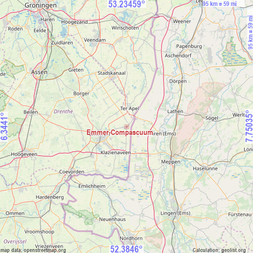
Emmer-Compascuum GPS coordinates[2]
52° 48' 42.012" North, 7° 2' 49.992" East
| Map corner | latitude | longitude |
|---|---|---|
| Upper-left | 53.23459°, | 6.3441° |
| Center: | 52.81167°, | 7.04722° |
| Lower-right: | 52.3846°, | 7.75035° |
| Map W x H: | 94.5×94.5 km | = 58.7×58.7mi |
| max Lat: | 53.48025° ⇑19.8% North |
| Emmer-Compascuum: | 52.81167° |
| min Lat: | ⇓80.2% South 50.76917° |
| min Long | Emmer-Compascuu | max Long |
| 3.38611° | 7.04722° | 7.16528° |
| W 99.6%⇐ | ⇒0.40000000000001% E |
Elevation
Elevation of Emmer-Compascuum is 13 m = 43 ft, and this is 2 m = 7 ft below average elevation for this country.
| Max E: |
203 m = 666 ft | 33% |
| Avg. | 15 m = 49 ft | |
| Emmer-Compascuum | 13 m = 43 ft | |
Min E: |
-6 m = -20 ft | 67% |
See also: Netherlands elevation on elevation.city.
Geographical zone
Emmer-Compascuum is located in North temperate zone (between Tropic of Cancer and the Arctic Circle). Distance of this North polar circle is 1529.1 km =950.1 mi to North.| Distance of | km | miles | from Emmer-Compascuum |
|---|---|---|---|
| North Pole | 4135 | 2569.4 | to North |
| Arctic Circle | 1529.1 | 950.1 | to North |
| Tropic Cancer | 3266.2 | 2029.5 | to South |
| Equator | 5872.1 | 3648.8 | to South |


Nearby cities:
15 places around Emmer-Compascuum: (largest is in red/bold)
• Angelslo
8.8 km =5.5 mi,  247°
247°
• Barger-Oosterveld
7.6 km =4.7 mi,  232°
232°
• Emmen
10.1 km =6.3 mi, 249°
• Emmer-Erfscheidenveen
4 km =2.5 mi,  261°
261°
• Emmerhout
7.8 km =4.8 mi, 249°
• Emmermeer
10.4 km =6.5 mi, 263°
• Emmerschans
7.4 km =4.6 mi, 260°
• Klazienaveen
10.5 km =6.5 mi,  201°
201°
• Nieuw-Dordrecht
8.8 km =5.5 mi,  217°
217°
• Noordbarge
11.6 km =7.2 mi, 247°
• Ter Apel
7.3 km =4.5 mi,  6°
6°
• Ter Apelkanaal
10.1 km =6.3 mi,  0°
0°
• Valthe
10.9 km =6.8 mi,  290°
290°
• Valthermond
9.6 km =6 mi,  323°
323°
• Weerdinge
8.7 km =5.4 mi,  275°
275°
Sources, notices
• [Note1] Compared only with cities in Netherlands existing in our database
• [Src1] Map data: © OpenStreetMap contributors (CC-BY-SA)
• [Src2] Other city data from geonames.org with taken over terms of usage.
• [Src3] Geographical zone / Annual Mean Temperature by Robert A. Rohde @ Wikipedia
