Beetsterzwaag geodata
Beetsterzwaag (Friesland) is a populated place; located in Netherlands in Europe/Amsterdam (GMT+2) time zone. With population of 3,485 people, there are 677 cities with bigger population in this country. Compared to other cities in Netherlands, 87.6% of cities are located further ↓South; 78.2% of cities are located further ←West and 54.1% of cities have higher elevation than Beetsterzwaag. Note1


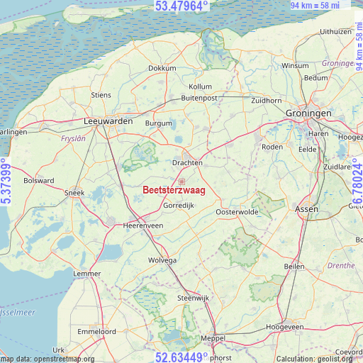
Beetsterzwaag GPS coordinates[2]
53° 3' 32.904" North, 6° 4' 37.596" East
| Map corner | latitude | longitude |
|---|---|---|
| Upper-left | 53.47964°, | 5.37399° |
| Center: | 53.05914°, | 6.07711° |
| Lower-right: | 52.63449°, | 6.78024° |
| Map W x H: | 94×94 km | = 58.4×58.4mi |
| max Lat: | 53.48025° ⇑12.4% North |
| Beetsterzwaag: | 53.05914° |
| min Lat: | ⇓87.6% South 50.76917° |
| min Long | Beetsterzwaag | max Long |
| 3.38611° | 6.07711° | 7.16528° |
| W 78.2%⇐ | ⇒21.8% E |
Elevation
Elevation of Beetsterzwaag is 5 m = 16 ft, and this is 10 m = 33 ft below average elevation for this country.
| Max E: |
203 m = 666 ft | 54.1% |
| Avg. | 15 m = 49 ft | |
| Beetsterzwaag | 5 m = 16 ft | |
Min E: |
-6 m = -20 ft | 45.9% |
See also: Netherlands elevation on elevation.city.
Geographical zone
Beetsterzwaag is located in North temperate zone (between Tropic of Cancer and the Arctic Circle). Distance of this North polar circle is 1501.6 km =933.1 mi to North.| Distance of | km | miles | from Beetsterzwaag |
|---|---|---|---|
| North Pole | 4107.4 | 2552.2 | to North |
| Arctic Circle | 1501.6 | 933.1 | to North |
| Tropic Cancer | 3293.7 | 2046.6 | to South |
| Equator | 5899.6 | 3665.8 | to South |


Nearby cities:
15 places around Beetsterzwaag: (largest is in red/bold)
• Boornbergum
3.4 km =2.1 mi,  321°
321°
• De Drait
4.3 km =2.7 mi,  351°
351°
• De Wilgen
5.3 km =3.3 mi,  327°
327°
• Drachten
6.1 km =3.8 mi,  13°
13°
• Drachtstercompagnie
9.4 km =5.8 mi,  27°
27°
• Gorredijk
5.9 km =3.7 mi,  188°
188°
• Hoornsterzwaag
9.3 km =5.8 mi,  136°
136°
• Jubbega
6.8 km =4.2 mi,  154°
154°
• Lippenhuizen
4.7 km =2.9 mi,  166°
166°
• Opeinde
8.4 km =5.2 mi, 350°
• Oudega
9 km =5.6 mi, 324°
• Terwispel
4.8 km =3 mi,  204°
204°
• Tijnje
6.5 km =4 mi,  240°
240°
• Ureterp
7.1 km =4.4 mi,  58°
58°
• Wijnjewoude
8.5 km =5.3 mi,  90°
90°
Sources, notices
• [Note1] Compared only with cities in Netherlands existing in our database
• [Src1] Map data: © OpenStreetMap contributors (CC-BY-SA)
• [Src2] Other city data from geonames.org with taken over terms of usage.
• [Src3] Geographical zone / Annual Mean Temperature by Robert A. Rohde @ Wikipedia
