Brattvåg geodata
Brattvåg (Møre og Romsdal) is a seat of a second-order administrative division; located in Norway in Europe/Oslo (GMT+2) time zone. With population of 2,146 people, there are 187 cities with bigger population in this country. Compared to other cities in Norway, 69.8% of cities are located further ↓South; 79% of cities are located further →East and 92.1% of cities have higher elevation than Brattvåg. Note1


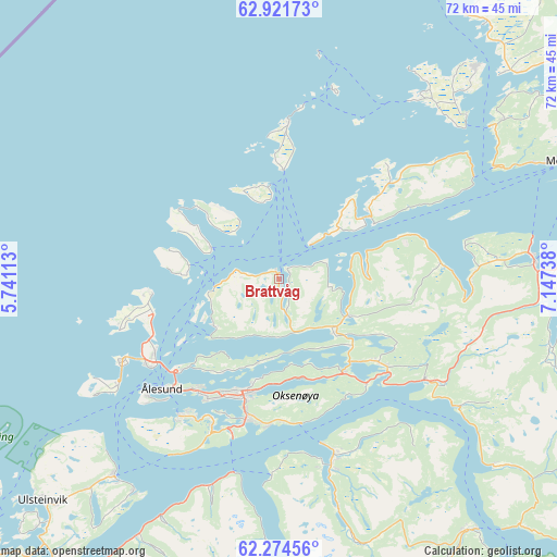
Brattvåg GPS coordinates[2]
62° 35' 59.676" North, 6° 26' 39.336" East
| Map corner | latitude | longitude |
|---|---|---|
| Upper-left | 62.92173°, | 5.74113° |
| Center: | 62.59991°, | 6.44426° |
| Lower-right: | 62.27456°, | 7.14738° |
| Map W x H: | 72×72 km | = 44.7×44.7mi |
| max Lat: | 71.04137° ⇑30.2% North |
| Brattvåg: | 62.59991° |
| min Lat: | ⇓69.8% South 58.0274° |
| min Long | Brattvåg | max Long |
| 4.71485° | 6.44426° | 31.11066° |
| W 21%⇐ | ⇒79% E |
Elevation
Elevation of Brattvåg is 3 m = 10 ft, and this is 101.2 m = 332 ft below average elevation for this country.
| Max E: |
897 m = 2943 ft | 92.1% |
| Avg. | 104.2 m = 342 ft | |
| Brattvåg | 3 m = 10 ft | |
Min E: |
1 m = 3 ft | 7.9% |
See also: Norway elevation on elevation.city.
Geographical zone
Brattvåg is located in North temperate zone (between Tropic of Cancer and the Arctic Circle). Distance of this North polar circle is 440.7 km =273.8 mi to North.| Distance of | km | miles | from Brattvåg |
|---|---|---|---|
| North Pole | 3046.6 | 1893.1 | to North |
| Arctic Circle | 440.7 | 273.8 | to North |
| Tropic Cancer | 4354.5 | 2705.8 | to South |
| Equator | 6960.5 | 4325.1 | to South |


Nearby cities:
15 places around Brattvåg: (largest is in red/bold)
• Giskemo
25.2 km =15.7 mi,  120°
120°
• Ikornnes
24.4 km =15.2 mi,  167°
167°
• Langevåg
21.9 km =13.6 mi,  216°
216°
• Midsund
14.3 km =8.9 mi,  55°
55°
• Nordstranda
18.7 km =11.6 mi,  239°
239°
• Roald
16.5 km =10.3 mi,  263°
263°
• Sjøholt
23 km =14.3 mi, 124°
• Skodje
16.6 km =10.3 mi,  129°
129°
• Steinshamn
20.5 km =12.7 mi,  3°
3°
• Sykkylven
23.8 km =14.8 mi,  162°
162°
• Syvik
9.2 km =5.7 mi,  233°
233°
• Tomra
25 km =15.5 mi,  94°
94°
• Valderøy
19.3 km =12 mi, 235°
• Vatne
10 km =6.2 mi, 117°
• Ålesund
20.5 km =12.7 mi, 226°
Sources, notices
• [Note1] Compared only with cities in Norway existing in our database
• [Src1] Map data: © OpenStreetMap contributors (CC-BY-SA)
• [Src2] Other city data from geonames.org with taken over terms of usage.
• [Src3] Geographical zone / Annual Mean Temperature by Robert A. Rohde @ Wikipedia
