Berkåk geodata
Berkåk (Trøndelag) is a seat of a second-order administrative division; located in Norway in Europe/Oslo (GMT+2) time zone. With population of 914 people, there are 330 cities with bigger population in this country. Compared to other cities in Norway, 71.5% of cities are located further ↓South; 51.3% of cities are located further →East and 96.5% of cities have lower elevation than Berkåk. Note1


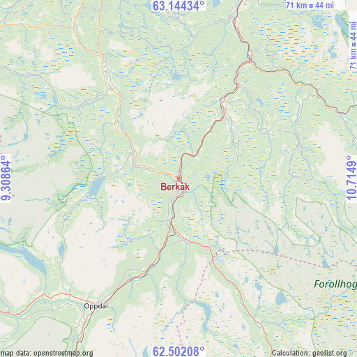
Berkåk GPS coordinates[2]
62° 49' 29.856" North, 10° 0' 42.372" East
| Map corner | latitude | longitude |
|---|---|---|
| Upper-left | 63.14434°, | 9.30864° |
| Center: | 62.82496°, | 10.01177° |
| Lower-right: | 62.50208°, | 10.7149° |
| Map W x H: | 71.4×71.4 km | = 44.4×44.4mi |
| max Lat: | 71.04137° ⇑28.5% North |
| Berkåk: | 62.82496° |
| min Lat: | ⇓71.5% South 58.0274° |
| min Long | Berkåk | max Long |
| 4.71485° | 10.01177° | 31.11066° |
| W 48.7%⇐ | ⇒51.3% E |
Elevation
Elevation of Berkåk is 470 m = 1542 ft, and this is 365.8 m = 1200 ft above average elevation for this country.
| Max E: |
897 m = 2943 ft | 3.5% |
| Berkåk | 470 m 1542 ft | |
| Avg. | 104.2 m = 342 ft | |
Min E: |
1 m = 3 ft | 96.5% |
See also: Norway elevation on elevation.city.
Geographical zone
Berkåk is located in North temperate zone (between Tropic of Cancer and the Arctic Circle). Distance of this North polar circle is 415.7 km =258.3 mi to North.| Distance of | km | miles | from Berkåk |
|---|---|---|---|
| North Pole | 3021.6 | 1877.5 | to North |
| Arctic Circle | 415.7 | 258.3 | to North |
| Tropic Cancer | 4379.6 | 2721.4 | to South |
| Equator | 6985.5 | 4340.6 | to South |


Nearby cities:
15 places around Berkåk: (largest is in red/bold)
• Børsa
55.9 km =34.7 mi,  2°
2°
• Hovin
33 km =20.5 mi,  18°
18°
• Klæbu
57.7 km =35.9 mi, 24°
• Lundamo
38.9 km =24.2 mi, 20°
• Løkken Verk
36.9 km =22.9 mi,  335°
335°
• Meldal
29 km =18 mi,  328°
328°
• Melhus
52.9 km =32.9 mi,  14°
14°
• Oppdal
30.4 km =18.9 mi,  212°
212°
• Orkanger
54.2 km =33.7 mi,  351°
351°
• Rindal
47.9 km =29.8 mi,  302°
302°
• Skaun
47.5 km =29.5 mi, 2°
• Støren
27.5 km =17.1 mi,  30°
30°
• Surnadal
67.3 km =41.8 mi,  284°
284°
• Tanem
59 km =36.7 mi, 21°
• Ålen
65.5 km =40.7 mi,  88°
88°
Sources, notices
• [Note1] Compared only with cities in Norway existing in our database
• [Src1] Map data: © OpenStreetMap contributors (CC-BY-SA)
• [Src2] Other city data from geonames.org with taken over terms of usage.
• [Src3] Geographical zone / Annual Mean Temperature by Robert A. Rohde @ Wikipedia
