Surnadal geodata
Surnadal (Møre og Romsdal) is a seat of a second-order administrative division; located in Norway in Europe/Oslo (GMT+2) time zone. In our database, there are 488 cities with bigger population. Compared to other cities in Norway, 72.6% of cities are located further ↓South; 61.6% of cities are located further →East and 70.7% of cities have lower elevation than Surnadal. Note1


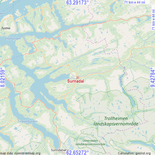
Surnadal GPS coordinates[2]
62° 58' 26.292" North, 8° 43' 28.992" East
| Map corner | latitude | longitude |
|---|---|---|
| Upper-left | 63.29173°, | 8.02159° |
| Center: | 62.97397°, | 8.72472° |
| Lower-right: | 62.65272°, | 9.42784° |
| Map W x H: | 71.1×71 km | = 44.2×44.1mi |
| max Lat: | 71.04137° ⇑27.4% North |
| Surnadal: | 62.97397° |
| min Lat: | ⇓72.6% South 58.0274° |
| min Long | Surnadal | max Long |
| 4.71485° | 8.72472° | 31.11066° |
| W 38.4%⇐ | ⇒61.6% E |
Elevation
Elevation of Surnadal is 124 m = 407 ft, and this is 19.8 m = 65 ft above average elevation for this country.
| Max E: |
897 m = 2943 ft | 29.3% |
| Surnadal | 124 m 407 ft | |
| Avg. | 104.2 m = 342 ft | |
Min E: |
1 m = 3 ft | 70.7% |
See also: Norway elevation on elevation.city.
Geographical zone
Surnadal is located in North temperate zone (between Tropic of Cancer and the Arctic Circle). Distance of this North polar circle is 399.1 km =248 mi to North.| Distance of | km | miles | from Surnadal |
|---|---|---|---|
| North Pole | 3005 | 1867.2 | to North |
| Arctic Circle | 399.1 | 248 | to North |
| Tropic Cancer | 4396.1 | 2731.6 | to South |
| Equator | 7002 | 4350.8 | to South |


Nearby cities:
15 places around Surnadal: (largest is in red/bold)
• Aure
34.1 km =21.2 mi,  343°
343°
• Batnfjordsøra
54 km =33.6 mi,  260°
260°
• Bruhagen
55.7 km =34.6 mi,  279°
279°
• Eidsvåg
40 km =24.9 mi,  236°
236°
• Grøa
36.7 km =22.8 mi,  180°
180°
• Kristiansund
52.5 km =32.6 mi,  286°
286°
• Krokstadøra
61.4 km =38.2 mi,  39°
39°
• Kyrksæterøra
39.7 km =24.7 mi,  27°
27°
• Liabøen
26.4 km =16.4 mi,  308°
308°
• Løkken Verk
52.2 km =32.4 mi,  71°
71°
• Meldal
50.5 km =31.4 mi,  80°
80°
• Rensvik
47.7 km =29.6 mi, 286°
• Rindal
26.2 km =16.3 mi, 69°
• Sunndalsøra
34.2 km =21.3 mi,  193°
193°
• Tingvoll
27.1 km =16.8 mi, 255°
Sources, notices
• [Note1] Compared only with cities in Norway existing in our database
• [Src1] Map data: © OpenStreetMap contributors (CC-BY-SA)
• [Src2] Other city data from geonames.org with taken over terms of usage.
• [Src3] Geographical zone / Annual Mean Temperature by Robert A. Rohde @ Wikipedia
