Arthur’s Pass geodata
Arthur’s Pass (Canterbury) is a populated place; located in New Zealand in Pacific/Auckland (GMT+12) time zone. With population of 930 people, there are 142 cities with bigger population in this country. Compared to other cities in New Zealand, 74.4% of cities are located further ↑North; 82.1% of cities are located further →East and 99.5% of cities have lower elevation than Arthur’s Pass. Note1


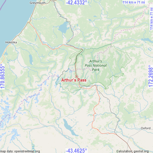
Arthur’s Pass GPS coordinates[2]
42° 57' 0" South, 171° 34' 0.012" East
| Map corner | latitude | longitude |
|---|---|---|
| Upper-left | -42.4332°, | 170.86355° |
| Center: | -42.95°, | 171.56667° |
| Lower-right: | -43.4625°, | 172.2698° |
| Map W x H: | 114.4×114.4 km | = 71.1×71.1mi |
| max Lat: | -34.99604° ⇑74.4% North |
| Arthur’s Pass: | -42.95° |
| min Lat: | ⇓25.6% South -46.6° |
| min Long | Arthur’s Pass | max Long |
| -176.55973° | 171.56667° | 178.33333° |
| W 17.9%⇐ | ⇒82.1% E |
Elevation
Elevation of Arthur’s Pass is 745 m = 2444 ft, and this is 660.6 m = 2167 ft above average elevation for this country.
| Max E: |
819 m = 2687 ft | 0.5% |
| Arthur’s Pass | 745 m 2444 ft | |
| Avg. | 84.4 m = 277 ft | |
Min E: |
3 m = 10 ft | 99.5% |
See also: New Zealand elevation on elevation.city.
Geographical zone
Arthur’s Pass is located in South temperate zone (between Tropic of Capricorn and the Antarctic Circle). Distance of this Southern Tropic circle is 2169.7 km =1348.2 mi to North.| Distance of | km | miles | from Arthur’s Pass |
|---|---|---|---|
| Equator | 4775.6 | 2967.4 | to North |
| Tropic Capricorn | 2169.7 | 1348.2 | to North |
| Antarctic Circle | 2625.6 | 1631.5 | to South |
| South Pole | 5231.5 | 3250.7 | to South |


Nearby cities:
15 places around Arthur’s Pass: (largest is in red/bold)
• Amberley
97.2 km =60.4 mi,  103°
103°
• Burnham
95.8 km =59.5 mi,  140°
140°
• Darfield
74.2 km =46.1 mi, 143°
• Dobson
59.7 km =37.1 mi,  338°
338°
• Gloriavale Christian Church
39.9 km =24.8 mi,  16°
16°
• Greymouth
61.5 km =38.2 mi,  330°
330°
• Hokitika
55.4 km =34.4 mi,  297°
297°
• Methven
76.3 km =47.4 mi,  174°
174°
• Oxford
63.4 km =39.4 mi,  127°
127°
• Rakaia
96.1 km =59.7 mi,  157°
157°
• Reefton
95.9 km =59.6 mi,  14°
14°
• Rolleston
96.6 km =60 mi, 136°
• Sefton
95.3 km =59.2 mi,  110°
110°
• Waikuku
98.6 km =61.3 mi, 113°
• Woodend
98.1 km =61 mi, 114°
Sources, notices
• [Note1] Compared only with cities in New Zealand existing in our database
• [Src1] Map data: © OpenStreetMap contributors (CC-BY-SA)
• [Src2] Other city data from geonames.org with taken over terms of usage.
• [Src3] Geographical zone / Annual Mean Temperature by Robert A. Rohde @ Wikipedia
