Rothesay Bay geodata
Rothesay Bay (Auckland) is a section of populated place; located in New Zealand in Pacific/Auckland (GMT+12) time zone. With population of 5,000 people, there are 58 cities with bigger population in this country. Compared to other cities in New Zealand, 88.4% of cities are located further ↓South; 54.6% of cities are located further ←West and 58.9% of cities have lower elevation than Rothesay Bay. Note1


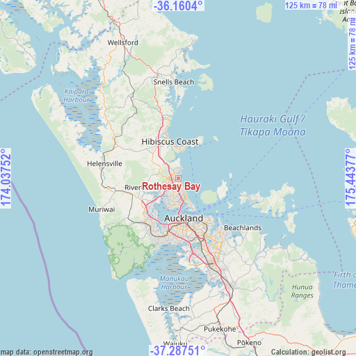
Rothesay Bay GPS coordinates[2]
36° 43' 33.672" South, 174° 44' 26.304" East
| Map corner | latitude | longitude |
|---|---|---|
| Upper-left | -36.1604°, | 174.03752° |
| Center: | -36.72602°, | 174.74064° |
| Lower-right: | -37.28751°, | 175.44377° |
| Map W x H: | 125.3×125.3 km | = 77.9×77.9mi |
| max Lat: | -34.99604° ⇑11.6% North |
| Rothesay Bay: | -36.72602° |
| min Lat: | ⇓88.4% South -46.6° |
| min Long | Rothesay Bay | max Long |
| -176.55973° | 174.74064° | 178.33333° |
| W 54.6%⇐ | ⇒45.4% E |
Elevation
Elevation of Rothesay Bay is 46 m = 151 ft, and this is 38.4 m = 126 ft below average elevation for this country.
| Max E: |
819 m = 2687 ft | 41.1% |
| Avg. | 84.4 m = 277 ft | |
| Rothesay Bay | 46 m = 151 ft | |
Min E: |
3 m = 10 ft | 58.9% |
See also: New Zealand elevation on elevation.city.
Geographical zone
Rothesay Bay is located in South temperate zone (between Tropic of Capricorn and the Antarctic Circle). Distance of this Southern Tropic circle is 1477.6 km =918.1 mi to North.| Distance of | km | miles | from Rothesay Bay |
|---|---|---|---|
| Equator | 4083.6 | 2537.4 | to North |
| Tropic Capricorn | 1477.6 | 918.1 | to North |
| Antarctic Circle | 3317.6 | 2061.5 | to South |
| South Pole | 5923.5 | 3680.7 | to South |


Nearby cities:
15 places around Rothesay Bay: (largest is in red/bold)
• Auckland
13.8 km =8.6 mi,  171°
171°
• East Tamaki
28.7 km =17.8 mi,  150°
150°
• Mangere
27.4 km =17 mi, 169°
• Manukau City
32.1 km =19.9 mi,  157°
157°
• Muriwai Beach
27.8 km =17.3 mi,  248°
248°
• Murrays Bay
0.9 km =0.6 mi,  105°
105°
• North Shore
8.3 km =5.2 mi, 174°
• Pakuranga
23.5 km =14.6 mi,  138°
138°
• Parakai
28.7 km =17.8 mi,  287°
287°
• Rosebank
17.7 km =11 mi,  200°
200°
• Tamaki
20.9 km =13 mi, 149°
• Titirangi
24.7 km =15.3 mi, 197°
• Waitakere
22.5 km =14 mi, 199°
• Warkworth
36.8 km =22.9 mi,  349°
349°
• Wiri
32.1 km =19.9 mi, 160°
Sources, notices
• [Note1] Compared only with cities in New Zealand existing in our database
• [Src1] Map data: © OpenStreetMap contributors (CC-BY-SA)
• [Src2] Other city data from geonames.org with taken over terms of usage.
• [Src3] Geographical zone / Annual Mean Temperature by Robert A. Rohde @ Wikipedia
