Nombre de Dios geodata
Nombre de Dios (Colón) is a seat of a third-order administrative division; located in Panama in America/Panama (GMT-5) time zone. With population of 872 people, there are 295 cities with bigger population in this country. Compared to other cities in Panama, 99.7% of cities are located further ↓South; 87.8% of cities are located further ←West and 90.4% of cities have higher elevation than Nombre de Dios. Note1


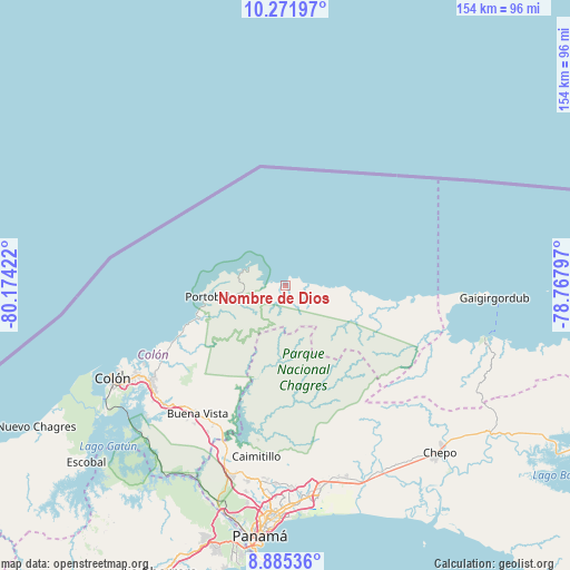
Nombre de Dios GPS coordinates[2]
9° 34' 45.732" North, 79° 28' 15.924" West
| Map corner | latitude | longitude |
|---|---|---|
| Upper-left | 10.27197°, | -80.17422° |
| Center: | 9.57937°, | -79.47109° |
| Lower-right: | 8.88536°, | -78.76797° |
| Map W x H: | 154.2×154.2 km | = 95.8×95.8mi |
| max Lat: | 9.60898° ⇑0.3% North |
| Nombre de Dios: | 9.57937° |
| min Lat: | ⇓99.7% South 7.26534° |
| min Long | Nombre de Dios | max Long |
| -82.91275° | -79.47109° | -77.38965° |
| W 87.8%⇐ | ⇒12.2% E |
Elevation
Elevation of Nombre de Dios is 12 m = 39 ft, and this is 160.1 m = 525 ft below average elevation for this country.
| Max E: |
2103 m = 6900 ft | 90.4% |
| Avg. | 172.1 m = 565 ft | |
| Nombre de Dios | 12 m = 39 ft | |
Min E: |
-1 m = -3 ft | 9.6% |
See also: Panama elevation on elevation.city.
Geographical zone
Nombre de Dios is located in North Torrid zone (between Equator and Tropic of Cancer). Distance of Equator is 1065.1 km =661.8 mi to South.| Distance of | km | miles | from Nombre de Dios |
|---|---|---|---|
| North Pole | 8941.9 | 5556.2 | to North |
| Arctic Circle | 6336 | 3937 | to North |
| Tropic Cancer | 1540.8 | 957.4 | to North |
| Equator | 1065.1 | 661.8 | to South |


Nearby cities:
15 places around Nombre de Dios: (largest is in red/bold)
• Cacique
16.3 km =10.1 mi,  281°
281°
• Cuango
17 km =10.6 mi,  94°
94°
• María Chiquita
34.7 km =21.6 mi,  243°
243°
• Miramar
14.8 km =9.2 mi, 91°
• Nuevo Tonosí
16.9 km =10.5 mi,  258°
258°
• Nuevo Vigía
40.3 km =25 mi,  201°
201°
• Palenque
11.9 km =7.4 mi,  95°
95°
• Palmira
27.9 km =17.3 mi, 98°
• Playa Chiquita
19.7 km =12.2 mi, 94°
• Portobelo
20.6 km =12.8 mi, 261°
• Salamanca
30.8 km =19.1 mi,  208°
208°
• Santa Isabel
30.5 km =19 mi, 98°
• Sardinilla
36.3 km =22.6 mi, 210°
• Viento Frío
7 km =4.3 mi, 87°
• Villa Alondra
40.2 km =25 mi, 237°
Sources, notices
• [Note1] Compared only with cities in Panama existing in our database
• [Src1] Map data: © OpenStreetMap contributors (CC-BY-SA)
• [Src2] Other city data from geonames.org with taken over terms of usage.
• [Src3] Geographical zone / Annual Mean Temperature by Robert A. Rohde @ Wikipedia
