Miraflores geodata
Miraflores (Coclé) is a populated place; located in Panama in America/Panama (GMT-5) time zone. With population of 799 people, there are 323 cities with bigger population in this country. Compared to other cities in Panama, 65.9% of cities are located further ↓South; 63.2% of cities are located further ←West and 83% of cities have lower elevation than Miraflores. Note1


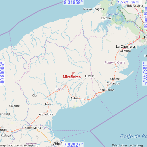
Miraflores GPS coordinates[2]
8° 37' 30.252" North, 80° 16' 36.948" West
| Map corner | latitude | longitude |
|---|---|---|
| Upper-left | 9.31959°, | -80.98006° |
| Center: | 8.62507°, | -80.27693° |
| Lower-right: | 7.92927°, | -79.57381° |
| Map W x H: | 154.6×154.6 km | = 96.1×96.1mi |
| max Lat: | 9.60898° ⇑34.1% North |
| Miraflores: | 8.62507° |
| min Lat: | ⇓65.9% South 7.26534° |
| min Long | Miraflores | max Long |
| -82.91275° | -80.27693° | -77.38965° |
| W 63.2%⇐ | ⇒36.8% E |
Elevation
Elevation of Miraflores is 307 m = 1007 ft, and this is 134.9 m = 443 ft above average elevation for this country.
| Max E: |
2103 m = 6900 ft | 17% |
| Miraflores | 307 m 1007 ft | |
| Avg. | 172.1 m = 565 ft | |
Min E: |
-1 m = -3 ft | 83% |
See also: Panama elevation on elevation.city.
Geographical zone
Miraflores is located in North Torrid zone (between Equator and Tropic of Cancer). Distance of Equator is 959 km =595.9 mi to South.| Distance of | km | miles | from Miraflores |
|---|---|---|---|
| North Pole | 9048 | 5622.2 | to North |
| Arctic Circle | 6442.2 | 4003 | to North |
| Tropic Cancer | 1646.9 | 1023.3 | to North |
| Equator | 959 | 595.9 | to South |


Nearby cities:
15 places around Miraflores: (largest is in red/bold)
• Alto de La Estancia
11 km =6.8 mi,  112°
112°
• Caimito
4.2 km =2.6 mi,  93°
93°
• Chiguirí Arriba
10.9 km =6.8 mi,  61°
61°
• Churuquita Chiquita
5.5 km =3.4 mi,  173°
173°
• Churuquita Grande
3.4 km =2.1 mi, 170°
• Entradero
9.9 km =6.2 mi,  129°
129°
• Membrillo
8.5 km =5.3 mi,  124°
124°
• Pajonal Abajo
4.9 km =3 mi,  155°
155°
• Rincón de Las Palmas
8.3 km =5.2 mi, 159°
• San Juan de Dios
9.9 km =6.2 mi,  145°
145°
• Sofre
6.7 km =4.2 mi,  99°
99°
• Sonadora
9.9 km =6.2 mi,  214°
214°
• Tambo
4.5 km =2.8 mi,  335°
335°
• Toabré
5.6 km =3.5 mi,  301°
301°
• Turega
9.2 km =5.7 mi, 98°
Sources, notices
• [Note1] Compared only with cities in Panama existing in our database
• [Src1] Map data: © OpenStreetMap contributors (CC-BY-SA)
• [Src2] Other city data from geonames.org with taken over terms of usage.
• [Src3] Geographical zone / Annual Mean Temperature by Robert A. Rohde @ Wikipedia
