Chepo geodata
Chepo (Panamá) is a populated place; located in Panama in America/Panama (GMT-5) time zone. With population of 12,912 people, there are 30 cities with bigger population in this country. Compared to other cities in Panama, 90.1% of cities are located further ↓South; 91.4% of cities are located further ←West and 83.8% of cities have higher elevation than Chepo. Note1


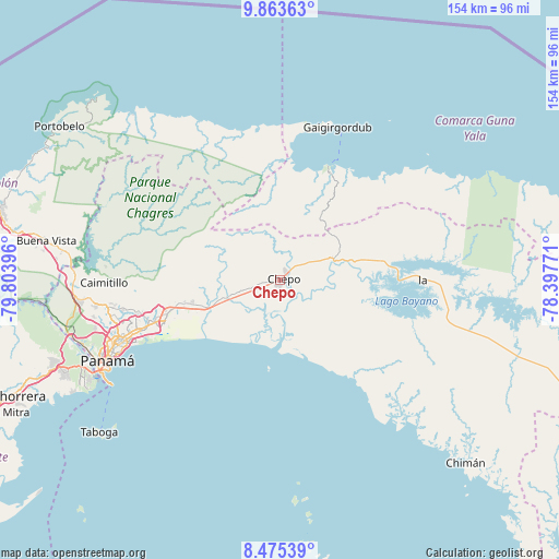
Chepo GPS coordinates[2]
9° 10' 12.684" North, 79° 6' 2.988" West
| Map corner | latitude | longitude |
|---|---|---|
| Upper-left | 9.86363°, | -79.80396° |
| Center: | 9.17019°, | -79.10083° |
| Lower-right: | 8.47539°, | -78.39771° |
| Map W x H: | 154.4×154.4 km | = 95.9×95.9mi |
| max Lat: | 9.60898° ⇑9.9% North |
| Chepo: | 9.17019° |
| min Lat: | ⇓90.1% South 7.26534° |
| min Long | Chepo | max Long |
| -82.91275° | -79.10083° | -77.38965° |
| W 91.4%⇐ | ⇒8.6% E |
Elevation
Elevation of Chepo is 19 m = 62 ft, and this is 153.1 m = 502 ft below average elevation for this country.
| Max E: |
2103 m = 6900 ft | 83.8% |
| Avg. | 172.1 m = 565 ft | |
| Chepo | 19 m = 62 ft | |
Min E: |
-1 m = -3 ft | 16.2% |
See also: Panama elevation on elevation.city.
Geographical zone
Chepo is located in North Torrid zone (between Equator and Tropic of Cancer). Distance of Equator is 1019.6 km =633.5 mi to South.| Distance of | km | miles | from Chepo |
|---|---|---|---|
| North Pole | 8987.4 | 5584.5 | to North |
| Arctic Circle | 6381.5 | 3965.3 | to North |
| Tropic Cancer | 1586.3 | 985.7 | to North |
| Equator | 1019.6 | 633.5 | to South |


Nearby cities:
15 places around Chepo: (largest is in red/bold)
• Cabra Número Uno
26.8 km =16.7 mi,  255°
255°
• Cañita
23.3 km =14.5 mi,  75°
75°
• Chepillo
24.2 km =15 mi,  187°
187°
• El Progreso
10.9 km =6.8 mi,  350°
350°
• Juan Gil
17.1 km =10.6 mi,  272°
272°
• La Mesa
19 km =11.8 mi, 270°
• Las Margaritas
2.2 km =1.4 mi,  43°
43°
• Los Lotes
21.3 km =13.2 mi, 256°
• Naranjal
15 km =9.3 mi,  251°
251°
• Nueva Esperanza
26.7 km =16.6 mi, 253°
• Pacora
23.1 km =14.4 mi,  244°
244°
• Paso Blanco
16.5 km =10.3 mi, 253°
• San Miguel
17.7 km =11 mi,  286°
286°
• Unión de Azuero
7.8 km =4.8 mi, 255°
• Vista Hermosa
29.3 km =18.2 mi, 257°
Sources, notices
• [Note1] Compared only with cities in Panama existing in our database
• [Src1] Map data: © OpenStreetMap contributors (CC-BY-SA)
• [Src2] Other city data from geonames.org with taken over terms of usage.
• [Src3] Geographical zone / Annual Mean Temperature by Robert A. Rohde @ Wikipedia
