Naranjal geodata
Naranjal (Panamá) is a populated place; located in Panama in America/Panama (GMT-5) time zone. With population of 552 people, there are 441 cities with bigger population in this country. Compared to other cities in Panama, 88.4% of cities are located further ↓South; 90.7% of cities are located further ←West and 67.4% of cities have higher elevation than Naranjal. Note1


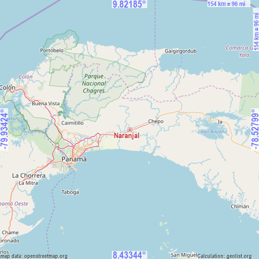
Naranjal GPS coordinates[2]
9° 7' 41.952" North, 79° 13' 51.996" West
| Map corner | latitude | longitude |
|---|---|---|
| Upper-left | 9.82185°, | -79.93424° |
| Center: | 9.12832°, | -79.23111° |
| Lower-right: | 8.43344°, | -78.52799° |
| Map W x H: | 154.4×154.4 km | = 95.9×95.9mi |
| max Lat: | 9.60898° ⇑11.6% North |
| Naranjal: | 9.12832° |
| min Lat: | ⇓88.4% South 7.26534° |
| min Long | Naranjal | max Long |
| -82.91275° | -79.23111° | -77.38965° |
| W 90.7%⇐ | ⇒9.3% E |
Elevation
Elevation of Naranjal is 39 m = 128 ft, and this is 133.1 m = 437 ft below average elevation for this country.
| Max E: |
2103 m = 6900 ft | 67.4% |
| Avg. | 172.1 m = 565 ft | |
| Naranjal | 39 m = 128 ft | |
Min E: |
-1 m = -3 ft | 32.6% |
See also: Panama elevation on elevation.city.
Geographical zone
Naranjal is located in North Torrid zone (between Equator and Tropic of Cancer). Distance of Equator is 1015 km =630.7 mi to South.| Distance of | km | miles | from Naranjal |
|---|---|---|---|
| North Pole | 8992.1 | 5587.4 | to North |
| Arctic Circle | 6386.2 | 3968.2 | to North |
| Tropic Cancer | 1590.9 | 988.5 | to North |
| Equator | 1015 | 630.7 | to South |


Nearby cities:
15 places around Naranjal: (largest is in red/bold)
• Cabra Número Uno
11.8 km =7.3 mi,  259°
259°
• Chepo
15 km =9.3 mi,  71°
71°
• Juan Gil
6.2 km =3.9 mi,  333°
333°
• La Mesa
6.9 km =4.3 mi,  316°
316°
• Las Margaritas
17 km =10.6 mi, 68°
• Los Lotes
6.4 km =4 mi,  265°
265°
• Nueva Esperanza
11.7 km =7.3 mi, 255°
• Nuevo Belén
18.9 km =11.7 mi,  253°
253°
• Pacora
8.4 km =5.2 mi,  229°
229°
• Paso Blanco
1.5 km =0.9 mi, 267°
• Rancho Café
15.5 km =9.6 mi, 268°
• San Miguel
10.1 km =6.3 mi,  344°
344°
• Tocumen
17.2 km =10.7 mi, 255°
• Unión de Azuero
7.2 km =4.5 mi, 68°
• Vista Hermosa
14.4 km =8.9 mi, 262°
Sources, notices
• [Note1] Compared only with cities in Panama existing in our database
• [Src1] Map data: © OpenStreetMap contributors (CC-BY-SA)
• [Src2] Other city data from geonames.org with taken over terms of usage.
• [Src3] Geographical zone / Annual Mean Temperature by Robert A. Rohde @ Wikipedia
