Lajero Arriba geodata
Lajero Arriba (Ngöbe-Buglé) is a seat of a third-order administrative division; located in Panama in America/Panama (GMT-5) time zone. With population of 617 people, there are 402 cities with bigger population in this country. Compared to other cities in Panama, 67.3% of cities are located further ↑North; 74.6% of cities are located further →East and 78.2% of cities have lower elevation than Lajero Arriba. Note1


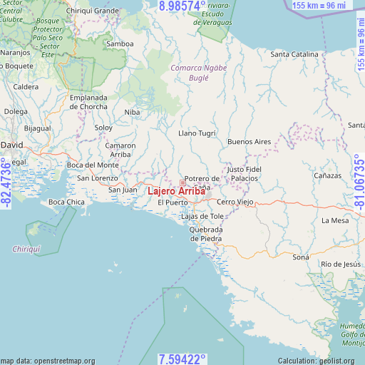
Lajero Arriba GPS coordinates[2]
8° 17' 26.16" North, 81° 46' 13.692" West
| Map corner | latitude | longitude |
|---|---|---|
| Upper-left | 8.98574°, | -82.4736° |
| Center: | 8.2906°, | -81.77047° |
| Lower-right: | 7.59422°, | -81.06735° |
| Map W x H: | 154.7×154.7 km | = 96.1×96.1mi |
| max Lat: | 9.60898° ⇑67.3% North |
| Lajero Arriba: | 8.2906° |
| min Lat: | ⇓32.7% South 7.26534° |
| min Long | Lajero Arriba | max Long |
| -82.91275° | -81.77047° | -77.38965° |
| W 25.4%⇐ | ⇒74.6% E |
Elevation
Elevation of Lajero Arriba is 233 m = 764 ft, and this is 60.9 m = 200 ft above average elevation for this country.
| Max E: |
2103 m = 6900 ft | 21.8% |
| Lajero Arriba | 233 m 764 ft | |
| Avg. | 172.1 m = 565 ft | |
Min E: |
-1 m = -3 ft | 78.2% |
See also: Panama elevation on elevation.city.
Geographical zone
Lajero Arriba is located in North Torrid zone (between Equator and Tropic of Cancer). Distance of Equator is 921.8 km =572.8 mi to South.| Distance of | km | miles | from Lajero Arriba |
|---|---|---|---|
| North Pole | 9085.2 | 5645.3 | to North |
| Arctic Circle | 6479.3 | 4026 | to North |
| Tropic Cancer | 1684.1 | 1046.5 | to North |
| Equator | 921.8 | 572.8 | to South |


Nearby cities:
15 places around Lajero Arriba: (largest is in red/bold)
• Cabecera de Cerro Puerco
3.3 km =2.1 mi,  21°
21°
• Cerro Ceniza
5.8 km =3.6 mi,  4°
4°
• Cerro Iglesias
3.1 km =1.9 mi,  258°
258°
• El Nancito
7.2 km =4.5 mi,  144°
144°
• El Porvenir
9.7 km =6 mi,  225°
225°
• El Puerto
9.6 km =6 mi,  205°
205°
• Hato Juli
10.5 km =6.5 mi,  308°
308°
• Las Matas
10.6 km =6.6 mi,  275°
275°
• Llano Junco
7.2 km =4.5 mi,  14°
14°
• Maraca
10.3 km =6.4 mi,  27°
27°
• Oma
7.5 km =4.7 mi,  332°
332°
• Potrero de Caña
7.9 km =4.9 mi,  87°
87°
• Remedios
9.7 km =6 mi,  220°
220°
• San Félix
10.6 km =6.6 mi,  270°
270°
• Santa Lucia
9 km =5.6 mi, 222°
Sources, notices
• [Note1] Compared only with cities in Panama existing in our database
• [Src1] Map data: © OpenStreetMap contributors (CC-BY-SA)
• [Src2] Other city data from geonames.org with taken over terms of usage.
• [Src3] Geographical zone / Annual Mean Temperature by Robert A. Rohde @ Wikipedia
