Llano Junco geodata
Llano Junco (Ngöbe-Buglé) is a populated place; located in Panama in America/Panama (GMT-5) time zone. With population of 537 people, there are 452 cities with bigger population in this country. Compared to other cities in Panama, 62.1% of cities are located further ↑North; 74.2% of cities are located further →East and 91.2% of cities have lower elevation than Llano Junco. Note1


Llano Junco GPS coordinates[2]
8° 21' 11.412" North, 81° 45' 16.02" West
| Map corner | latitude | longitude |
|---|---|---|
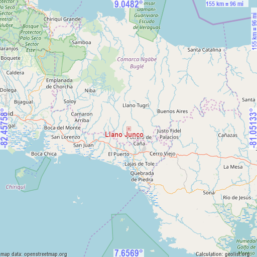
| Upper-left | 9.0482°, | -82.45758° |
| Center: | 8.35317°, | -81.75445° |
| Lower-right: | 7.6569°, | -81.05133° |
| Map W x H: | 154.7×154.7 km | = 96.1×96.1mi |
| max Lat: | 9.60898° ⇑62.1% North |
| Llano Junco: | 8.35317° |
| min Lat: | ⇓37.9% South 7.26534° |
| min Long | Llano Junco | max Long |
| -82.91275° | -81.75445° | -77.38965° |
| W 25.8%⇐ | ⇒74.2% E |
Elevation
Elevation of Llano Junco is 465 m = 1526 ft, and this is 292.9 m = 961 ft above average elevation for this country.
| Max E: |
2103 m = 6900 ft | 8.8% |
| Llano Junco | 465 m 1526 ft | |
| Avg. | 172.1 m = 565 ft | |
Min E: |
-1 m = -3 ft | 91.2% |
See also: Panama elevation on elevation.city.
Geographical zone
Llano Junco is located in North Torrid zone (between Equator and Tropic of Cancer). Distance of Equator is 928.8 km =577.1 mi to South.| Distance of | km | miles | from Llano Junco |
|---|---|---|---|
| North Pole | 9078.3 | 5641 | to North |
| Arctic Circle | 6472.4 | 4021.8 | to North |
| Tropic Cancer | 1677.1 | 1042.1 | to North |
| Equator | 928.8 | 577.1 | to South |


Nearby cities:
15 places around Llano Junco: (largest is in red/bold)
• Cabecera de Cerro Puerco
3.9 km =2.4 mi,  188°
188°
• Cerro Ceniza
1.7 km =1.1 mi,  228°
228°
• Cerro Iglesias
8.9 km =5.5 mi,  212°
212°
• Cerro Mosquito
7.2 km =4.5 mi,  94°
94°
• Chichica
9.8 km =6.1 mi,  81°
81°
• Chichica
9.8 km =6.1 mi, 86°
• Hato Chami
10.2 km =6.3 mi,  349°
349°
• Hato Juli
10 km =6.2 mi,  267°
267°
• Lajero Arriba
7.2 km =4.5 mi, 194°
• Maraca
3.7 km =2.3 mi,  53°
53°
• Oma
5.2 km =3.2 mi, 266°
• Peña Prieta
4.5 km =2.8 mi,  64°
64°
• Potrero de Caña
9 km =5.6 mi,  137°
137°
• Quebrada Canoa
9.5 km =5.9 mi,  340°
340°
• Tebujo
5.3 km =3.3 mi,  42°
42°
Sources, notices
• [Note1] Compared only with cities in Panama existing in our database
• [Src1] Map data: © OpenStreetMap contributors (CC-BY-SA)
• [Src2] Other city data from geonames.org with taken over terms of usage.
• [Src3] Geographical zone / Annual Mean Temperature by Robert A. Rohde @ Wikipedia
