Cerro El Castillo geodata
Cerro El Castillo (Panamá Oeste) is a populated place; located in Panama in America/Panama (GMT-5) time zone. With population of 630 people, there are 396 cities with bigger population in this country. Compared to other cities in Panama, 82.2% of cities are located further ↓South; 83.2% of cities are located further ←West and 53.7% of cities have higher elevation than Cerro El Castillo. Note1


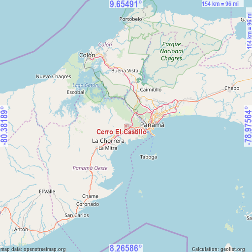
Cerro El Castillo GPS coordinates[2]
8° 57' 39.78" North, 79° 40' 43.536" West
| Map corner | latitude | longitude |
|---|---|---|
| Upper-left | 9.65491°, | -80.38189° |
| Center: | 8.96105°, | -79.67876° |
| Lower-right: | 8.26586°, | -78.97564° |
| Map W x H: | 154.4×154.5 km | = 95.9×96mi |
| max Lat: | 9.60898° ⇑17.8% North |
| Cerro El Castillo: | 8.96105° |
| min Lat: | ⇓82.2% South 7.26534° |
| min Long | Cerro El Castil | max Long |
| -82.91275° | -79.67876° | -77.38965° |
| W 83.2%⇐ | ⇒16.8% E |
Elevation
Elevation of Cerro El Castillo is 64 m = 210 ft, and this is 108.1 m = 355 ft below average elevation for this country.
| Max E: |
2103 m = 6900 ft | 53.7% |
| Avg. | 172.1 m = 565 ft | |
| Cerro El Castillo | 64 m = 210 ft | |
Min E: |
-1 m = -3 ft | 46.3% |
See also: Panama elevation on elevation.city.
Geographical zone
Cerro El Castillo is located in North Torrid zone (between Equator and Tropic of Cancer). Distance of Equator is 996.4 km =619.1 mi to South.| Distance of | km | miles | from Cerro El Castillo |
|---|---|---|---|
| North Pole | 9010.7 | 5599 | to North |
| Arctic Circle | 6404.8 | 3979.8 | to North |
| Tropic Cancer | 1609.5 | 1000.1 | to North |
| Equator | 996.4 | 619.1 | to South |


Nearby cities:
15 places around Cerro El Castillo: (largest is in red/bold)
• Arraiján
2.3 km =1.4 mi,  116°
116°
• Hato Montaña
8.1 km =5 mi,  235°
235°
• Howard
9.9 km =6.2 mi,  104°
104°
• Monte Claro
3.8 km =2.4 mi,  162°
162°
• Nuevo Arraiján
6.1 km =3.8 mi,  228°
228°
• Nuevo Emperador
7.4 km =4.6 mi,  308°
308°
• Nuevo Guararé
5.2 km =3.2 mi, 233°
• Paraíso
9.8 km =6.1 mi,  35°
35°
• Puerto Caimito
10.8 km =6.7 mi,  201°
201°
• Río Congo
9.1 km =5.7 mi,  273°
273°
• Río Potrero
2.4 km =1.5 mi, 271°
• San José
6.7 km =4.2 mi, 242°
• San Vicente de Bique
5.5 km =3.4 mi,  174°
174°
• Veracruz
9.8 km =6.1 mi,  143°
143°
• Vista Alegre
4.6 km =2.9 mi,  215°
215°
Sources, notices
• [Note1] Compared only with cities in Panama existing in our database
• [Src1] Map data: © OpenStreetMap contributors (CC-BY-SA)
• [Src2] Other city data from geonames.org with taken over terms of usage.
• [Src3] Geographical zone / Annual Mean Temperature by Robert A. Rohde @ Wikipedia
