Luya geodata
Luya (Amazonas) is a seat of a third-order administrative division; located in Peru in America/Lima (GMT-5) time zone. In our database, there are 305 cities with bigger population. Compared to other cities in Peru, 88.5% of cities are located further ↓South; 80.2% of cities are located further →East and 62.1% of cities have higher elevation than Luya. Note1


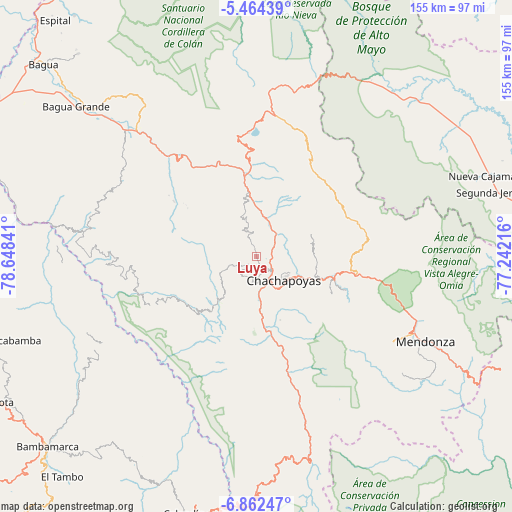
Luya GPS coordinates[2]
6° 9' 50.004" South, 77° 56' 43.008" West
| Map corner | latitude | longitude |
|---|---|---|
| Upper-left | -5.46439°, | -78.64841° |
| Center: | -6.16389°, | -77.94528° |
| Lower-right: | -6.86247°, | -77.24216° |
| Map W x H: | 155.5×155.5 km | = 96.6×96.6mi |
| max Lat: | -0.96667° ⇑11.5% North |
| Luya: | -6.16389° |
| min Lat: | ⇓88.5% South -18.01465° |
| min Long | Luya | max Long |
| -81.30472° | -77.94528° | -69.04167° |
| W 19.8%⇐ | ⇒80.2% E |
Elevation
Elevation of Luya is 2311 m = 7582 ft, and this is 7.6999999999998 m = 25 ft below average elevation for this country.
| Max E: |
5022 m = 16476 ft | 62.1% |
| Avg. | 2318.7 m = 7607 ft | |
| Luya | 2311 m = 7582 ft | |
Min E: |
1 m = 3 ft | 37.9% |
See also: Peru elevation on elevation.city.
Geographical zone
Luya is located in South Torrid zone (between Equator and Tropic of Capricorn). Distance of Equator is 685.4 km =425.9 mi to North.| Distance of | km | miles | from Luya |
|---|---|---|---|
| Equator | 685.4 | 425.9 | to North |
| Tropic Capricorn | 1920.6 | 1193.4 | to South |
| Antarctic Circle | 6715.8 | 4173 | to South |
| South Pole | 9321.7 | 5792.2 | to South |


Nearby cities:
15 places around Luya: (largest is in red/bold)
• Chachapoyas
11.3 km =7 mi,  131°
131°
• Churuja
16.7 km =10.4 mi,  356°
356°
• Colcamar
15.6 km =9.7 mi,  191°
191°
• Daguas
23.7 km =14.7 mi,  107°
107°
• Huancas
8.9 km =5.5 mi,  97°
97°
• Inguilpata
8.7 km =5.4 mi, 188°
• Lamud
3.1 km =1.9 mi,  342°
342°
• Levanto
16.9 km =10.5 mi,  162°
162°
• Lonya Chico
7.6 km =4.7 mi, 189°
• Maino
20.5 km =12.7 mi, 159°
• Olto
7 km =4.3 mi,  347°
347°
• Paclas
11.8 km =7.3 mi, 342°
• San Carlos
22 km =13.7 mi,  3°
3°
• Santa Catalina
14.1 km =8.8 mi,  294°
294°
• Tingo
23.4 km =14.5 mi,  170°
170°
Sources, notices
• [Note1] Compared only with cities in Peru existing in our database
• [Src1] Map data: © OpenStreetMap contributors (CC-BY-SA)
• [Src2] Other city data from geonames.org with taken over terms of usage.
• [Src3] Geographical zone / Annual Mean Temperature by Robert A. Rohde @ Wikipedia
