Churuja geodata
Churuja (Amazonas) is a seat of a third-order administrative division; located in Peru in America/Lima (GMT-5) time zone. In our database, there are 305 cities with bigger population. Compared to other cities in Peru, 90.2% of cities are located further ↓South; 80.3% of cities are located further →East and 70.1% of cities have higher elevation than Churuja. Note1


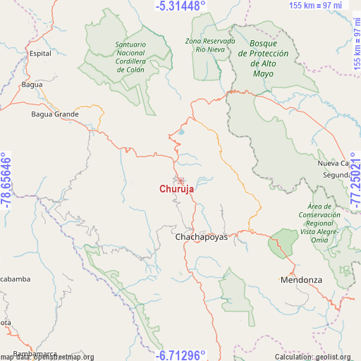
Churuja GPS coordinates[2]
6° 0' 51.012" South, 77° 57' 11.988" West
| Map corner | latitude | longitude |
|---|---|---|
| Upper-left | -5.31448°, | -78.65646° |
| Center: | -6.01417°, | -77.95333° |
| Lower-right: | -6.71296°, | -77.25021° |
| Map W x H: | 155.5×155.5 km | = 96.6×96.6mi |
| max Lat: | -0.96667° ⇑9.8% North |
| Churuja: | -6.01417° |
| min Lat: | ⇓90.2% South -18.01465° |
| min Long | Churuja | max Long |
| -81.30472° | -77.95333° | -69.04167° |
| W 19.7%⇐ | ⇒80.3% E |
Elevation
Elevation of Churuja is 1414 m = 4639 ft, and this is 904.7 m = 2968 ft below average elevation for this country.
| Max E: |
5022 m = 16476 ft | 70.1% |
| Avg. | 2318.7 m = 7607 ft | |
| Churuja | 1414 m = 4639 ft | |
Min E: |
1 m = 3 ft | 29.9% |
See also: Peru elevation on elevation.city.
Geographical zone
Churuja is located in South Torrid zone (between Equator and Tropic of Capricorn). Distance of Equator is 668.7 km =415.5 mi to North.| Distance of | km | miles | from Churuja |
|---|---|---|---|
| Equator | 668.7 | 415.5 | to North |
| Tropic Capricorn | 1937.2 | 1203.7 | to South |
| Antarctic Circle | 6732.5 | 4183.4 | to South |
| South Pole | 9338.3 | 5802.5 | to South |


Nearby cities:
15 places around Churuja: (largest is in red/bold)
• Chachapoyas
25.9 km =16.1 mi,  158°
158°
• Chisquilla
28.3 km =17.6 mi,  59°
59°
• Colcamar
32 km =19.9 mi,  183°
183°
• Cuispes
11.1 km =6.9 mi,  11°
11°
• Huancas
20.3 km =12.6 mi,  151°
151°
• Inguilpata
25.2 km =15.7 mi, 180°
• Lamud
13.7 km =8.5 mi, 180°
• Lonya Chico
24.1 km =15 mi, 180°
• Luya
16.7 km =10.4 mi, 176°
• Olto
9.8 km =6.1 mi, 183°
• Paclas
5.9 km =3.7 mi,  205°
205°
• Quinjalca
31.6 km =19.6 mi,  105°
105°
• San Carlos
5.7 km =3.5 mi,  22°
22°
• Santa Catalina
16.1 km =10 mi,  227°
227°
• Yambrasbamba
30 km =18.6 mi, 11°
Sources, notices
• [Note1] Compared only with cities in Peru existing in our database
• [Src1] Map data: © OpenStreetMap contributors (CC-BY-SA)
• [Src2] Other city data from geonames.org with taken over terms of usage.
• [Src3] Geographical zone / Annual Mean Temperature by Robert A. Rohde @ Wikipedia
