Chachapoyas geodata
Chachapoyas (Amazonas) is a seat of a first-order administrative division; located in Peru in America/Lima (GMT-5) time zone. With population of 20,279 people, there are 86 cities with bigger population in this country. Compared to other cities in Peru, 88.1% of cities are located further ↓South; 78.9% of cities are located further →East and 61.3% of cities have higher elevation than Chachapoyas. Note1
Administrative division(s):
- Level 1: Amazonas
- Level 2: Provincia de Chachapoyas
- Level 3: Chachapoyas


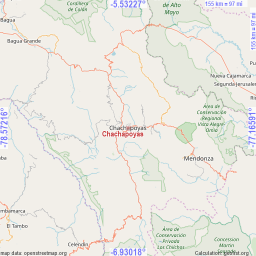
Chachapoyas GPS coordinates[2]
6° 13' 54.084" South, 77° 52' 8.508" West
| Map corner | latitude | longitude |
|---|---|---|
| Upper-left | -5.53227°, | -78.57216° |
| Center: | -6.23169°, | -77.86903° |
| Lower-right: | -6.93018°, | -77.16591° |
| Map W x H: | 155.4×155.4 km | = 96.6×96.6mi |
| max Lat: | -0.96667° ⇑11.9% North |
| Chachapoyas: | -6.23169° |
| min Lat: | ⇓88.1% South -18.01465° |
| min Long | Chachapoyas | max Long |
| -81.30472° | -77.86903° | -69.04167° |
| W 21.1%⇐ | ⇒78.9% E |
Elevation
Elevation of Chachapoyas is 2360 m = 7743 ft, and this is 41.3 m = 135 ft above average elevation for this country.
| Max E: |
5022 m = 16476 ft | 61.3% |
| Chachapoyas | 2360 m 7743 ft | |
| Avg. | 2318.7 m = 7607 ft | |
Min E: |
1 m = 3 ft | 38.7% |
See also: Peru elevation on elevation.city.
Geographical zone
Chachapoyas is located in South Torrid zone (between Equator and Tropic of Capricorn). Distance of Equator is 692.9 km =430.5 mi to North.| Distance of | km | miles | from Chachapoyas |
|---|---|---|---|
| Equator | 692.9 | 430.5 | to North |
| Tropic Capricorn | 1913 | 1188.7 | to South |
| Antarctic Circle | 6708.3 | 4168.3 | to South |
| South Pole | 9314.2 | 5787.6 | to South |


Nearby cities:
15 places around Chachapoyas: (largest is in red/bold)
• Cheto
18.9 km =11.7 mi,  98°
98°
• Colcamar
13.8 km =8.6 mi,  235°
235°
• Daguas
14.2 km =8.8 mi,  87°
87°
• Huancas
6.4 km =4 mi,  3°
3°
• Inguilpata
9.8 km =6.1 mi,  264°
264°
• Lamud
14.1 km =8.8 mi,  318°
318°
• Levanto
9.1 km =5.7 mi,  200°
200°
• Lonya Chico
9.7 km =6 mi,  270°
270°
• Luya
11.3 km =7 mi,  311°
311°
• Magdalena
16.1 km =10 mi,  192°
192°
• Maino
11.7 km =7.3 mi, 185°
• Olto
17.5 km =10.9 mi,  325°
325°
• Paclas
22.3 km =13.9 mi, 327°
• Soloco
14.2 km =8.8 mi, 103°
• Tingo
16.3 km =10.1 mi, 196°
Sources, notices
• [Note1] Compared only with cities in Peru existing in our database
• [Src1] Map data: © OpenStreetMap contributors (CC-BY-SA)
• [Src2] Other city data from geonames.org with taken over terms of usage.
• [Src3] Geographical zone / Annual Mean Temperature by Robert A. Rohde @ Wikipedia
