Lambayeque geodata
Lambayeque is a seat of a third-order administrative division; located in Peru in America/Lima (GMT-5) time zone. With population of 43,710 people, there are 41 cities with bigger population in this country. Compared to other cities in Peru, 82.4% of cities are located further ↓South; 96.1% of cities are located further →East and 96.1% of cities have higher elevation than Lambayeque. Note1
Administrative division(s):
- Level 1: Lambayeque
- Level 2: Provincia de Lambayeque
- Level 3: Lambayeque


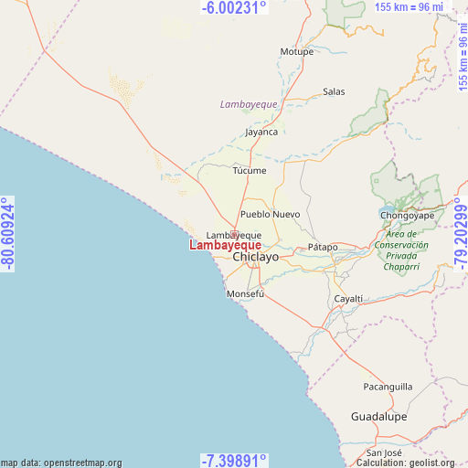
Lambayeque GPS coordinates[2]
6° 42' 3.996" South, 79° 54' 21.996" West
| Map corner | latitude | longitude |
|---|---|---|
| Upper-left | -6.00231°, | -80.60924° |
| Center: | -6.70111°, | -79.90611° |
| Lower-right: | -7.39891°, | -79.20299° |
| Map W x H: | 155.3×155.3 km | = 96.5×96.5mi |
| max Lat: | -0.96667° ⇑17.6% North |
| Lambayeque: | -6.70111° |
| min Lat: | ⇓82.4% South -18.01465° |
| min Long | Lambayeque | max Long |
| -81.30472° | -79.90611° | -69.04167° |
| W 3.9%⇐ | ⇒96.1% E |
Elevation
Elevation of Lambayeque is 23 m = 75 ft, and this is 2295.7 m = 7532 ft below average elevation for this country.
| Max E: |
5022 m = 16476 ft | 96.1% |
| Avg. | 2318.7 m = 7607 ft | |
| Lambayeque | 23 m = 75 ft | |
Min E: |
1 m = 3 ft | 3.9% |
See also: Lambayeque elevation on elevation.city.
Geographical zone
Lambayeque is located in South Torrid zone (between Equator and Tropic of Capricorn). Distance of Equator is 745.1 km =463 mi to North.| Distance of | km | miles | from Lambayeque |
|---|---|---|---|
| Equator | 745.1 | 463 | to North |
| Tropic Capricorn | 1860.8 | 1156.2 | to South |
| Antarctic Circle | 6656.1 | 4135.9 | to South |
| South Pole | 9262 | 5755.1 | to South |


Nearby cities:
15 places around Lambayeque: (largest is in red/bold)
• Chiclayo
10.6 km =6.6 mi,  137°
137°
• Eten
23.5 km =14.6 mi,  168°
168°
• Ferreñafe
14.7 km =9.1 mi,  61°
61°
• Manuel Antonio Mesones Muro
19.6 km =12.2 mi,  70°
70°
• Mochumí
18.2 km =11.3 mi,  15°
15°
• Monsefú
19.7 km =12.2 mi, 167°
• Mórrope
21.8 km =13.5 mi,  327°
327°
• Picsi
15.2 km =9.4 mi,  97°
97°
• Pimentel
15.4 km =9.6 mi,  191°
191°
• Pomalca
16 km =9.9 mi,  117°
117°
• Reque
20.7 km =12.9 mi,  151°
151°
• San José
9.6 km =6 mi, 115°
• Santa Rosa
10.7 km =6.6 mi,  125°
125°
• Santa Rosa
20.1 km =12.5 mi,  184°
184°
• Túcume
22.3 km =13.9 mi,  13°
13°
Sources, notices
• [Note1] Compared only with cities in Peru existing in our database
• [Src1] Map data: © OpenStreetMap contributors (CC-BY-SA)
• [Src2] Other city data from geonames.org with taken over terms of usage.
• [Src3] Geographical zone / Annual Mean Temperature by Robert A. Rohde @ Wikipedia
