Cheto geodata
Cheto (Amazonas) is a seat of a third-order administrative division; located in Peru in America/Lima (GMT-5) time zone. In our database, there are 305 cities with bigger population. Compared to other cities in Peru, 87.8% of cities are located further ↓South; 75.9% of cities are located further →East and 64% of cities have higher elevation than Cheto. Note1


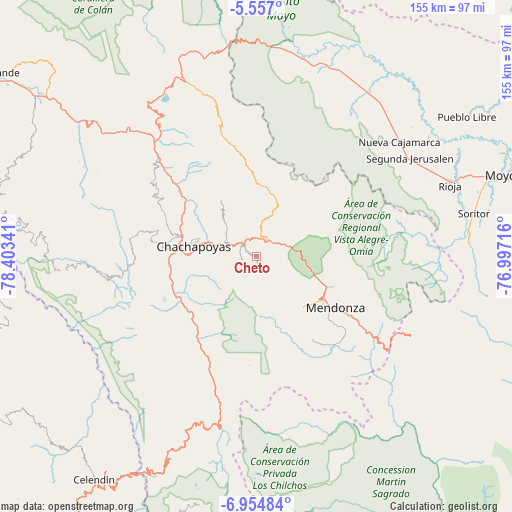
Cheto GPS coordinates[2]
6° 15' 23.004" South, 77° 42' 1.008" West
| Map corner | latitude | longitude |
|---|---|---|
| Upper-left | -5.557°, | -78.40341° |
| Center: | -6.25639°, | -77.70028° |
| Lower-right: | -6.95484°, | -76.99716° |
| Map W x H: | 155.4×155.4 km | = 96.6×96.6mi |
| max Lat: | -0.96667° ⇑12.2% North |
| Cheto: | -6.25639° |
| min Lat: | ⇓87.8% South -18.01465° |
| min Long | Cheto | max Long |
| -81.30472° | -77.70028° | -69.04167° |
| W 24.1%⇐ | ⇒75.9% E |
Elevation
Elevation of Cheto is 2139 m = 7018 ft, and this is 179.7 m = 590 ft below average elevation for this country.
| Max E: |
5022 m = 16476 ft | 64% |
| Avg. | 2318.7 m = 7607 ft | |
| Cheto | 2139 m = 7018 ft | |
Min E: |
1 m = 3 ft | 36% |
See also: Peru elevation on elevation.city.
Geographical zone
Cheto is located in South Torrid zone (between Equator and Tropic of Capricorn). Distance of Equator is 695.6 km =432.2 mi to North.| Distance of | km | miles | from Cheto |
|---|---|---|---|
| Equator | 695.6 | 432.2 | to North |
| Tropic Capricorn | 1910.3 | 1187 | to South |
| Antarctic Circle | 6705.5 | 4166.6 | to South |
| South Pole | 9311.4 | 5785.8 | to South |


Nearby cities:
15 places around Cheto: (largest is in red/bold)
• Chachapoyas
18.9 km =11.7 mi,  278°
278°
• Cochamal
21.1 km =13.1 mi,  142°
142°
• Daguas
5.5 km =3.4 mi,  306°
306°
• Granada
19.3 km =12 mi,  24°
24°
• Huambo
26.3 km =16.3 mi, 136°
• Huancas
20.4 km =12.7 mi,  296°
296°
• Levanto
22.7 km =14.1 mi,  255°
255°
• Longar
22.2 km =13.8 mi,  129°
129°
• Lonya Chico
28.4 km =17.6 mi, 275°
• Magdalena
25.6 km =15.9 mi,  239°
239°
• Maino
21.8 km =13.5 mi,  245°
245°
• Olleros
23.9 km =14.9 mi,  14°
14°
• Quinjalca
18.4 km =11.4 mi, 7°
• Soloco
4.9 km =3 mi, 262°
• Tingo
26.7 km =16.6 mi, 241°
Sources, notices
• [Note1] Compared only with cities in Peru existing in our database
• [Src1] Map data: © OpenStreetMap contributors (CC-BY-SA)
• [Src2] Other city data from geonames.org with taken over terms of usage.
• [Src3] Geographical zone / Annual Mean Temperature by Robert A. Rohde @ Wikipedia
