Yangas geodata
Yangas (Lima region) is a seat of a third-order administrative division; located in Peru in America/Lima (GMT-5) time zone. In our database, there are 305 cities with bigger population. Compared to other cities in Peru, 51.3% of cities are located further ↓South; 65.8% of cities are located further →East and 73.1% of cities have higher elevation than Yangas. Note1
Administrative division(s):
- Level 1: Lima region
- Level 2: Provincia de Canta
- Level 3: Santa Rosa De Quives


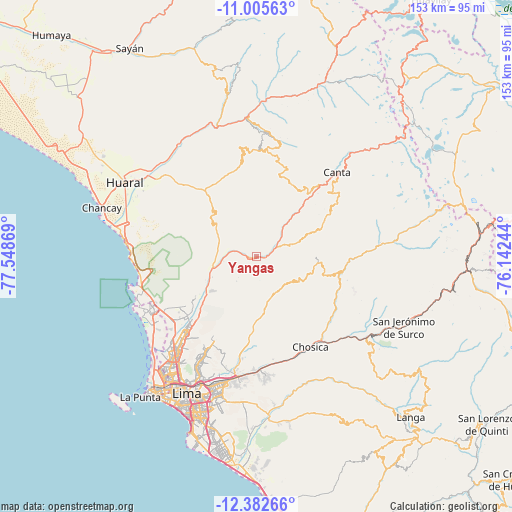
Yangas GPS coordinates[2]
11° 41' 42" South, 76° 50' 44.016" West
| Map corner | latitude | longitude |
|---|---|---|
| Upper-left | -11.00563°, | -77.54869° |
| Center: | -11.695°, | -76.84556° |
| Lower-right: | -12.38266°, | -76.14244° |
| Map W x H: | 153.1×153.1 km | = 95.1×95.1mi |
| max Lat: | -0.96667° ⇑48.7% North |
| Yangas: | -11.695° |
| min Lat: | ⇓51.3% South -18.01465° |
| min Long | Yangas | max Long |
| -81.30472° | -76.84556° | -69.04167° |
| W 34.2%⇐ | ⇒65.8% E |
Elevation
Elevation of Yangas is 921 m = 3022 ft, and this is 1397.7 m = 4586 ft below average elevation for this country.
| Max E: |
5022 m = 16476 ft | 73.1% |
| Avg. | 2318.7 m = 7607 ft | |
| Yangas | 921 m = 3022 ft | |
Min E: |
1 m = 3 ft | 26.9% |
See also: Peru elevation on elevation.city.
Geographical zone
Yangas is located in South Torrid zone (between Equator and Tropic of Capricorn). Distance of Equator is 1300.4 km =808 mi to North.| Distance of | km | miles | from Yangas |
|---|---|---|---|
| Equator | 1300.4 | 808 | to North |
| Tropic Capricorn | 1305.6 | 811.3 | to South |
| Antarctic Circle | 6100.8 | 3790.9 | to South |
| South Pole | 8706.7 | 5410.1 | to South |


Nearby cities:
15 places around Yangas: (largest is in red/bold)
• Arahuay
20.8 km =12.9 mi,  67°
67°
• Asentamiento Humano Nicolas de Pierola
30.8 km =19.1 mi,  150°
150°
• Callahuanca
29 km =18 mi,  120°
120°
• Carabayllo
27.3 km =17 mi,  229°
229°
• Chaclacayo
33.1 km =20.6 mi,  165°
165°
• Chosica
31.3 km =19.4 mi, 151°
• Huamantanga
24.2 km =15 mi,  25°
25°
• Lachaqui
28.9 km =18 mi,  56°
56°
• Laraos
33.5 km =20.8 mi,  84°
84°
• Ricardo Palma
32.4 km =20.1 mi,  140°
140°
• San Buenaventura
30.4 km =18.9 mi,  41°
41°
• Santa Eulalia
30.3 km =18.8 mi, 139°
• Santa María
34.9 km =21.7 mi,  188°
188°
• Sumbilca
32.1 km =19.9 mi,  4°
4°
• Urb. Santo Domingo
28.7 km =17.8 mi, 225°
Sources, notices
• [Note1] Compared only with cities in Peru existing in our database
• [Src1] Map data: © OpenStreetMap contributors (CC-BY-SA)
• [Src2] Other city data from geonames.org with taken over terms of usage.
• [Src3] Geographical zone / Annual Mean Temperature by Robert A. Rohde @ Wikipedia
