San Buenaventura geodata
San Buenaventura (Lima region) is a seat of a third-order administrative division; located in Peru in America/Lima (GMT-5) time zone. In our database, there are 305 cities with bigger population. Compared to other cities in Peru, 52.5% of cities are located further ↓South; 61.5% of cities are located further →East and 54.4% of cities have higher elevation than San Buenaventura. Note1
Administrative division(s):
- Level 1: Lima region
- Level 2: Provincia de Canta
- Level 3: San Buenaventura


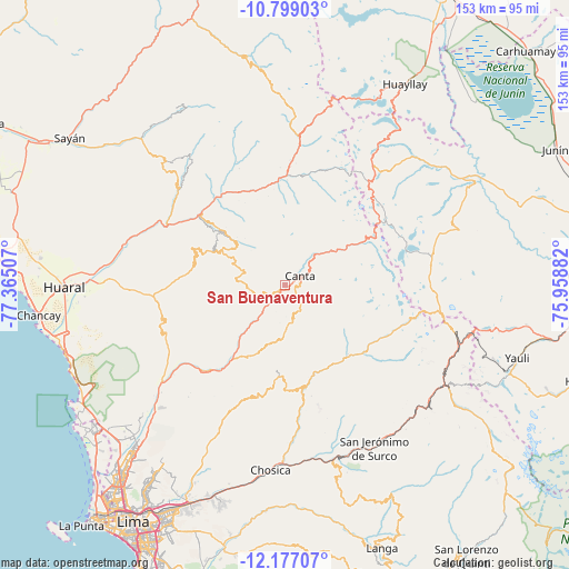
San Buenaventura GPS coordinates[2]
11° 29' 20.004" South, 76° 39' 42.984" West
| Map corner | latitude | longitude |
|---|---|---|
| Upper-left | -10.79903°, | -77.36507° |
| Center: | -11.48889°, | -76.66194° |
| Lower-right: | -12.17707°, | -75.95882° |
| Map W x H: | 153.2×153.2 km | = 95.2×95.2mi |
| max Lat: | -0.96667° ⇑47.5% North |
| San Buenaventura: | -11.48889° |
| min Lat: | ⇓52.5% South -18.01465° |
| min Long | San Buenaventur | max Long |
| -81.30472° | -76.66194° | -69.04167° |
| W 38.5%⇐ | ⇒61.5% E |
Elevation
Elevation of San Buenaventura is 2707 m = 8881 ft, and this is 388.3 m = 1274 ft above average elevation for this country.
| Max E: |
5022 m = 16476 ft | 54.4% |
| San Buenaventura | 2707 m 8881 ft | |
| Avg. | 2318.7 m = 7607 ft | |
Min E: |
1 m = 3 ft | 45.6% |
See also: Peru elevation on elevation.city.
Geographical zone
San Buenaventura is located in South Torrid zone (between Equator and Tropic of Capricorn). Distance of Equator is 1277.4 km =793.7 mi to North.| Distance of | km | miles | from San Buenaventura |
|---|---|---|---|
| Equator | 1277.4 | 793.7 | to North |
| Tropic Capricorn | 1328.5 | 825.5 | to South |
| Antarctic Circle | 6123.7 | 3805.1 | to South |
| South Pole | 8729.6 | 5424.3 | to South |


Nearby cities:
15 places around San Buenaventura: (largest is in red/bold)
• Acos
29.5 km =18.3 mi,  324°
324°
• Arahuay
14.8 km =9.2 mi,  183°
183°
• Canta
4.8 km =3 mi,  59°
59°
• Carac
35.4 km =22 mi,  338°
338°
• Carampoma
25 km =15.5 mi,  139°
139°
• Huamantanga
9.5 km =5.9 mi,  263°
263°
• Huanza
25.4 km =15.8 mi, 137°
• Huaros
13.1 km =8.1 mi,  45°
45°
• Lachaqui
8.3 km =5.2 mi,  149°
149°
• Lampian
34 km =21.1 mi,  325°
325°
• Laraos
23.7 km =14.7 mi, 145°
• Pacaraos
33.7 km =20.9 mi,  2°
2°
• Pirca
28.3 km =17.6 mi, 1°
• Sumbilca
19.5 km =12.1 mi,  297°
297°
• Yangas
30.4 km =18.9 mi,  221°
221°
Sources, notices
• [Note1] Compared only with cities in Peru existing in our database
• [Src1] Map data: © OpenStreetMap contributors (CC-BY-SA)
• [Src2] Other city data from geonames.org with taken over terms of usage.
• [Src3] Geographical zone / Annual Mean Temperature by Robert A. Rohde @ Wikipedia
