Tomas geodata
Tomas (Lima region) is a seat of a third-order administrative division; located in Peru in America/Lima (GMT-5) time zone. In our database, there are 305 cities with bigger population. Compared to other cities in Peru, 55.6% of cities are located further ↑North; 50.2% of cities are located further →East and 90.9% of cities have lower elevation than Tomas. Note1


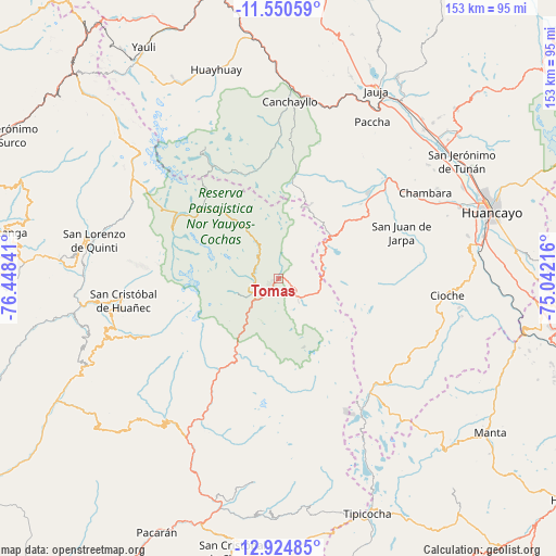
Tomas GPS coordinates[2]
12° 14' 18.996" South, 75° 44' 43.008" West
| Map corner | latitude | longitude |
|---|---|---|
| Upper-left | -11.55059°, | -76.44841° |
| Center: | -12.23861°, | -75.74528° |
| Lower-right: | -12.92485°, | -75.04216° |
| Map W x H: | 152.8×152.8 km | = 94.9×94.9mi |
| max Lat: | -0.96667° ⇑55.6% North |
| Tomas: | -12.23861° |
| min Lat: | ⇓44.4% South -18.01465° |
| min Long | Tomas | max Long |
| -81.30472° | -75.74528° | -69.04167° |
| W 49.8%⇐ | ⇒50.2% E |
Elevation
Elevation of Tomas is 3869 m = 12694 ft, and this is 1550.3 m = 5086 ft above average elevation for this country.
| Max E: |
5022 m = 16476 ft | 9.1% |
| Tomas | 3869 m 12694 ft | |
| Avg. | 2318.7 m = 7607 ft | |
Min E: |
1 m = 3 ft | 90.9% |
See also: Peru elevation on elevation.city.
Geographical zone
Tomas is located in South Torrid zone (between Equator and Tropic of Capricorn). Distance of this Southern Tropic circle is 1245.1 km =773.7 mi to South.| Distance of | km | miles | from Tomas |
|---|---|---|---|
| Equator | 1360.8 | 845.6 | to North |
| Tropic Capricorn | 1245.1 | 773.7 | to South |
| Antarctic Circle | 6040.4 | 3753.3 | to South |
| South Pole | 8646.3 | 5372.6 | to South |


Nearby cities:
15 places around Tomas: (largest is in red/bold)
• Ahuac
47 km =29.2 mi,  66°
66°
• Alis
6.3 km =3.9 mi,  225°
225°
• Canchayllo
48.2 km =30 mi,  3°
3°
• Carania
17.8 km =11.1 mi, 228°
• Chambara
46.4 km =28.8 mi,  57°
57°
• Colonia
46.6 km =29 mi,  199°
199°
• Huancaya
7 km =4.3 mi,  304°
304°
• Jarpa
33.2 km =20.6 mi, 65°
• Laraos
12.8 km =8 mi, 200°
• Llocllapampa
48.6 km =30.2 mi,  15°
15°
• Miraflores
12 km =7.5 mi,  251°
251°
• Tanta
32.5 km =20.2 mi,  294°
294°
• Vitis
6.8 km =4.2 mi,  284°
284°
• Yanacancha
36 km =22.4 mi,  83°
83°
• Yauyos
30.8 km =19.1 mi,  217°
217°
Sources, notices
• [Note1] Compared only with cities in Peru existing in our database
• [Src1] Map data: © OpenStreetMap contributors (CC-BY-SA)
• [Src2] Other city data from geonames.org with taken over terms of usage.
• [Src3] Geographical zone / Annual Mean Temperature by Robert A. Rohde @ Wikipedia
