Tanta geodata
Tanta (Lima region) is a seat of a third-order administrative division; located in Peru in America/Lima (GMT-5) time zone. In our database, there are 305 cities with bigger population. Compared to other cities in Peru, 54.6% of cities are located further ↑North; 53.1% of cities are located further →East and 98.1% of cities have lower elevation than Tanta. Note1


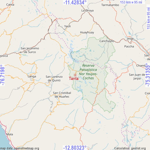
Tanta GPS coordinates[2]
12° 7' 0.012" South, 76° 1' 0.012" West
| Map corner | latitude | longitude |
|---|---|---|
| Upper-left | -11.42834°, | -76.7198° |
| Center: | -12.11667°, | -76.01667° |
| Lower-right: | -12.80323°, | -75.31355° |
| Map W x H: | 152.9×152.9 km | = 95×95mi |
| max Lat: | -0.96667° ⇑54.6% North |
| Tanta: | -12.11667° |
| min Lat: | ⇓45.4% South -18.01465° |
| min Long | Tanta | max Long |
| -81.30472° | -76.01667° | -69.04167° |
| W 46.9%⇐ | ⇒53.1% E |
Elevation
Elevation of Tanta is 4315 m = 14157 ft, and this is 1996.3 m = 6550 ft above average elevation for this country.
| Max E: |
5022 m = 16476 ft | 1.9% |
| Tanta | 4315 m 14157 ft | |
| Avg. | 2318.7 m = 7607 ft | |
Min E: |
1 m = 3 ft | 98.1% |
See also: Peru elevation on elevation.city.
Geographical zone
Tanta is located in South Torrid zone (between Equator and Tropic of Capricorn). Distance of this Southern Tropic circle is 1258.7 km =782.1 mi to South.| Distance of | km | miles | from Tanta |
|---|---|---|---|
| Equator | 1347.2 | 837.1 | to North |
| Tropic Capricorn | 1258.7 | 782.1 | to South |
| Antarctic Circle | 6053.9 | 3761.7 | to South |
| South Pole | 8659.8 | 5380.9 | to South |


Nearby cities:
15 places around Tanta: (largest is in red/bold)
• Alis
30.8 km =19.1 mi,  125°
125°
• Canchayllo
47.5 km =29.5 mi,  43°
43°
• Carania
30 km =18.6 mi,  147°
147°
• Huampara
31.6 km =19.6 mi,  214°
214°
• Huancaya
25.6 km =15.9 mi,  112°
112°
• Lahuaytambo
41.7 km =25.9 mi,  272°
272°
• Laraos
35.8 km =22.2 mi,  135°
135°
• Mariatana
37.5 km =23.3 mi,  246°
246°
• Miraflores
25.2 km =15.7 mi, 133°
• Quinocay
36.4 km =22.6 mi,  220°
220°
• Sangallaya
27.7 km =17.2 mi,  258°
258°
• Suitucancha
37.7 km =23.4 mi,  13°
13°
• Tomas
32.5 km =20.2 mi, 114°
• Vitis
25.8 km =16 mi,  117°
117°
• Yauyos
39.6 km =24.6 mi,  164°
164°
Sources, notices
• [Note1] Compared only with cities in Peru existing in our database
• [Src1] Map data: © OpenStreetMap contributors (CC-BY-SA)
• [Src2] Other city data from geonames.org with taken over terms of usage.
• [Src3] Geographical zone / Annual Mean Temperature by Robert A. Rohde @ Wikipedia
