Tapacocha geodata
Tapacocha (Ancash) is a seat of a third-order administrative division; located in Peru in America/Lima (GMT-5) time zone. In our database, there are 305 cities with bigger population. Compared to other cities in Peru, 61.1% of cities are located further ↓South; 73.8% of cities are located further →East and 77.5% of cities have lower elevation than Tapacocha. Note1


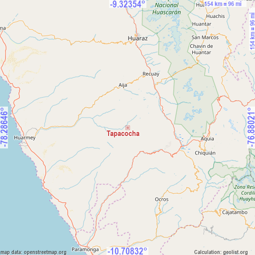
Tapacocha GPS coordinates[2]
10° 1' 0.012" South, 77° 34' 59.988" West
| Map corner | latitude | longitude |
|---|---|---|
| Upper-left | -9.32354°, | -78.28646° |
| Center: | -10.01667°, | -77.58333° |
| Lower-right: | -10.70832°, | -76.88021° |
| Map W x H: | 154×154 km | = 95.7×95.7mi |
| max Lat: | -0.96667° ⇑38.9% North |
| Tapacocha: | -10.01667° |
| min Lat: | ⇓61.1% South -18.01465° |
| min Long | Tapacocha | max Long |
| -81.30472° | -77.58333° | -69.04167° |
| W 26.2%⇐ | ⇒73.8% E |
Elevation
Elevation of Tapacocha is 3480 m = 11417 ft, and this is 1161.3 m = 3810 ft above average elevation for this country.
| Max E: |
5022 m = 16476 ft | 22.5% |
| Tapacocha | 3480 m 11417 ft | |
| Avg. | 2318.7 m = 7607 ft | |
Min E: |
1 m = 3 ft | 77.5% |
See also: Peru elevation on elevation.city.
Geographical zone
Tapacocha is located in South Torrid zone (between Equator and Tropic of Capricorn). Distance of Equator is 1113.7 km =692 mi to North.| Distance of | km | miles | from Tapacocha |
|---|---|---|---|
| Equator | 1113.7 | 692 | to North |
| Tropic Capricorn | 1492.2 | 927.2 | to South |
| Antarctic Circle | 6287.4 | 3906.8 | to South |
| South Pole | 8893.3 | 5526 | to South |


Nearby cities:
15 places around Tapacocha: (largest is in red/bold)
• Aija
26.4 km =16.4 mi,  353°
353°
• Cajacay
22 km =13.7 mi,  134°
134°
• Catac
29.2 km =18.1 mi,  34°
34°
• Chasquitambo
31.6 km =19.6 mi,  183°
183°
• Coris
27.4 km =17 mi,  318°
318°
• Cotaparaco
2.6 km =1.6 mi, 315°
• Huayllapampa
6.6 km =4.1 mi,  124°
124°
• La Merced
31.5 km =19.6 mi, 353°
• Llacllin
6.7 km =4.2 mi,  213°
213°
• Malvas
15.6 km =9.7 mi, 315°
• Marca
14.4 km =8.9 mi, 123°
• Pampas Chico
23.1 km =14.4 mi, 118°
• Recuay
35.6 km =22.1 mi,  23°
23°
• Succha
21.7 km =13.5 mi,  340°
340°
• Ticapampa
33.1 km =20.6 mi, 26°
Sources, notices
• [Note1] Compared only with cities in Peru existing in our database
• [Src1] Map data: © OpenStreetMap contributors (CC-BY-SA)
• [Src2] Other city data from geonames.org with taken over terms of usage.
• [Src3] Geographical zone / Annual Mean Temperature by Robert A. Rohde @ Wikipedia
