Malvas geodata
Malvas (Ancash) is a seat of a third-order administrative division; located in Peru in America/Lima (GMT-5) time zone. In our database, there are 305 cities with bigger population. Compared to other cities in Peru, 61.7% of cities are located further ↓South; 75.7% of cities are located further →East and 55.1% of cities have higher elevation than Malvas. Note1


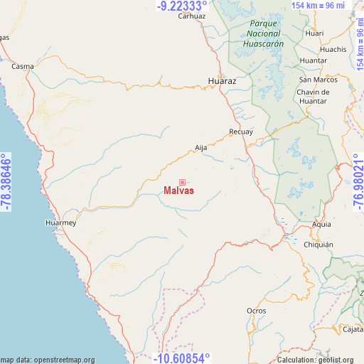
Malvas GPS coordinates[2]
9° 55' 0.012" South, 77° 40' 59.988" West
| Map corner | latitude | longitude |
|---|---|---|
| Upper-left | -9.22333°, | -78.38646° |
| Center: | -9.91667°, | -77.68333° |
| Lower-right: | -10.60854°, | -76.98021° |
| Map W x H: | 154×154 km | = 95.7×95.7mi |
| max Lat: | -0.96667° ⇑38.3% North |
| Malvas: | -9.91667° |
| min Lat: | ⇓61.7% South -18.01465° |
| min Long | Malvas | max Long |
| -81.30472° | -77.68333° | -69.04167° |
| W 24.3%⇐ | ⇒75.7% E |
Elevation
Elevation of Malvas is 2680 m = 8793 ft, and this is 361.3 m = 1185 ft above average elevation for this country.
| Max E: |
5022 m = 16476 ft | 55.1% |
| Malvas | 2680 m 8793 ft | |
| Avg. | 2318.7 m = 7607 ft | |
Min E: |
1 m = 3 ft | 44.9% |
See also: Peru elevation on elevation.city.
Geographical zone
Malvas is located in South Torrid zone (between Equator and Tropic of Capricorn). Distance of Equator is 1102.6 km =685.1 mi to North.| Distance of | km | miles | from Malvas |
|---|---|---|---|
| Equator | 1102.6 | 685.1 | to North |
| Tropic Capricorn | 1503.3 | 934.1 | to South |
| Antarctic Circle | 6298.5 | 3913.7 | to South |
| South Pole | 8904.4 | 5532.9 | to South |


Nearby cities:
15 places around Malvas: (largest is in red/bold)
• Aija
17.1 km =10.6 mi,  28°
28°
• Cajamarquilla
32.3 km =20.1 mi,  346°
346°
• Catac
30.3 km =18.8 mi,  64°
64°
• Coris
11.8 km =7.3 mi,  321°
321°
• Cotaparaco
13 km =8.1 mi,  135°
135°
• Huanchay
26.2 km =16.3 mi, 321°
• Huayllapampa
22.1 km =13.7 mi,  132°
132°
• La Merced
21.5 km =13.4 mi,  19°
19°
• Llacllin
18.2 km =11.3 mi,  156°
156°
• Marca
29.8 km =18.5 mi, 129°
• Pampas
32.3 km =20.1 mi,  329°
329°
• Recuay
33 km =20.5 mi,  48°
48°
• Succha
10 km =6.2 mi, 21°
• Tapacocha
15.6 km =9.7 mi, 135°
• Ticapampa
31.6 km =19.6 mi, 54°
Sources, notices
• [Note1] Compared only with cities in Peru existing in our database
• [Src1] Map data: © OpenStreetMap contributors (CC-BY-SA)
• [Src2] Other city data from geonames.org with taken over terms of usage.
• [Src3] Geographical zone / Annual Mean Temperature by Robert A. Rohde @ Wikipedia
