Quinocay geodata
Quinocay (Lima region) is a seat of a third-order administrative division; located in Peru in America/Lima (GMT-5) time zone. In our database, there are 305 cities with bigger population. Compared to other cities in Peru, 56.6% of cities are located further ↑North; 55.5% of cities are located further →East and 60.3% of cities have higher elevation than Quinocay. Note1


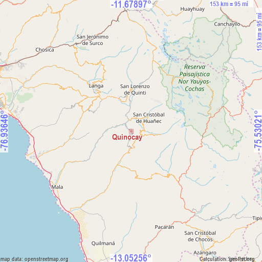
Quinocay GPS coordinates[2]
12° 22' 0.012" South, 76° 13' 59.988" West
| Map corner | latitude | longitude |
|---|---|---|
| Upper-left | -11.67897°, | -76.93646° |
| Center: | -12.36667°, | -76.23333° |
| Lower-right: | -13.05256°, | -75.53021° |
| Map W x H: | 152.7×152.7 km | = 94.9×94.9mi |
| max Lat: | -0.96667° ⇑56.6% North |
| Quinocay: | -12.36667° |
| min Lat: | ⇓43.4% South -18.01465° |
| min Long | Quinocay | max Long |
| -81.30472° | -76.23333° | -69.04167° |
| W 44.5%⇐ | ⇒55.5% E |
Elevation
Elevation of Quinocay is 2430 m = 7972 ft, and this is 111.3 m = 365 ft above average elevation for this country.
| Max E: |
5022 m = 16476 ft | 60.3% |
| Quinocay | 2430 m 7972 ft | |
| Avg. | 2318.7 m = 7607 ft | |
Min E: |
1 m = 3 ft | 39.7% |
See also: Peru elevation on elevation.city.
Geographical zone
Quinocay is located in South Torrid zone (between Equator and Tropic of Capricorn). Distance of this Southern Tropic circle is 1230.9 km =764.8 mi to South.| Distance of | km | miles | from Quinocay |
|---|---|---|---|
| Equator | 1375 | 854.4 | to North |
| Tropic Capricorn | 1230.9 | 764.8 | to South |
| Antarctic Circle | 6026.1 | 3744.4 | to South |
| South Pole | 8632 | 5363.7 | to South |


Nearby cities:
15 places around Quinocay: (largest is in red/bold)
• Calango
38 km =23.6 mi,  242°
242°
• Carania
39.7 km =24.7 mi,  86°
86°
• Coayllo
48 km =29.8 mi,  211°
211°
• Colonia
47.5 km =29.5 mi,  128°
128°
• Huampara
5.7 km =3.5 mi,  71°
71°
• Lahuaytambo
34.7 km =21.6 mi,  328°
328°
• Laraos
48.6 km =30.2 mi, 87°
• Mariatana
16.9 km =10.5 mi,  320°
320°
• Miraflores
42.9 km =26.7 mi,  76°
76°
• Omas
17.5 km =10.9 mi,  198°
198°
• Sangallaya
22.5 km =14 mi,  350°
350°
• Tanta
36.4 km =22.6 mi,  40°
40°
• Tauripampa
27.2 km =16.9 mi,  152°
152°
• Vitis
49 km =30.4 mi, 71°
• Yauyos
35.8 km =22.2 mi,  106°
106°
Sources, notices
• [Note1] Compared only with cities in Peru existing in our database
• [Src1] Map data: © OpenStreetMap contributors (CC-BY-SA)
• [Src2] Other city data from geonames.org with taken over terms of usage.
• [Src3] Geographical zone / Annual Mean Temperature by Robert A. Rohde @ Wikipedia
