Colca geodata
Colca (Junin) is a seat of a third-order administrative division; located in Peru in America/Lima (GMT-5) time zone. In our database, there are 305 cities with bigger population. Compared to other cities in Peru, 56.1% of cities are located further ↑North; 56.7% of cities are located further ←West and 96.8% of cities have lower elevation than Colca. Note1


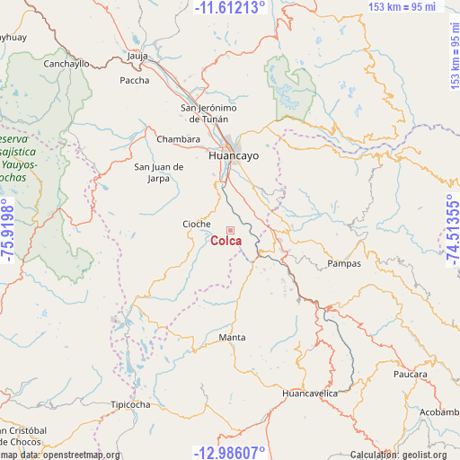
Colca GPS coordinates[2]
12° 18' 0" South, 75° 13' 0.012" West
| Map corner | latitude | longitude |
|---|---|---|
| Upper-left | -11.61213°, | -75.9198° |
| Center: | -12.3°, | -75.21667° |
| Lower-right: | -12.98607°, | -74.51355° |
| Map W x H: | 152.8×152.8 km | = 94.9×94.9mi |
| max Lat: | -0.96667° ⇑56.1% North |
| Colca: | -12.3° |
| min Lat: | ⇓43.9% South -18.01465° |
| min Long | Colca | max Long |
| -81.30472° | -75.21667° | -69.04167° |
| W 56.7%⇐ | ⇒43.3% E |
Elevation
Elevation of Colca is 4176 m = 13701 ft, and this is 1857.3 m = 6094 ft above average elevation for this country.
| Max E: |
5022 m = 16476 ft | 3.2% |
| Colca | 4176 m 13701 ft | |
| Avg. | 2318.7 m = 7607 ft | |
Min E: |
1 m = 3 ft | 96.8% |
See also: Peru elevation on elevation.city.
Geographical zone
Colca is located in South Torrid zone (between Equator and Tropic of Capricorn). Distance of this Southern Tropic circle is 1238.3 km =769.4 mi to South.| Distance of | km | miles | from Colca |
|---|---|---|---|
| Equator | 1367.6 | 849.8 | to North |
| Tropic Capricorn | 1238.3 | 769.4 | to South |
| Antarctic Circle | 6033.5 | 3749 | to South |
| South Pole | 8639.4 | 5368.3 | to South |


Nearby cities:
15 places around Colca: (largest is in red/bold)
• Chacapampa
6.6 km =4.1 mi,  213°
213°
• Chicche
7.2 km =4.5 mi,  270°
270°
• Chupaca
26.9 km =16.7 mi,  344°
344°
• Cuenca
24.8 km =15.4 mi,  126°
126°
• Cullhuas
9.2 km =5.7 mi,  36°
36°
• El Tambo
25.9 km =16.1 mi,  0°
0°
• Huacrapuquio
13 km =8.1 mi, 0°
• Huancayo
26.1 km =16.2 mi, 2°
• Huayllahuara
12.4 km =7.7 mi,  153°
153°
• Huayucachi
18.6 km =11.6 mi,  354°
354°
• Pazos
13.2 km =8.2 mi,  73°
73°
• Pilchaca
16.9 km =10.5 mi, 131°
• Sapallanga
17.1 km =10.6 mi,  12°
12°
• Vilca
20.7 km =12.9 mi,  169°
169°
• Yanacancha
24.4 km =15.2 mi,  297°
297°
Sources, notices
• [Note1] Compared only with cities in Peru existing in our database
• [Src1] Map data: © OpenStreetMap contributors (CC-BY-SA)
• [Src2] Other city data from geonames.org with taken over terms of usage.
• [Src3] Geographical zone / Annual Mean Temperature by Robert A. Rohde @ Wikipedia
