Challhuahuacho geodata
Challhuahuacho (Apurímac) is a seat of a third-order administrative division; located in Peru in America/Lima (GMT-5) time zone. In our database, there are 305 cities with bigger population. Compared to other cities in Peru, 76.5% of cities are located further ↑North; 78.7% of cities are located further ←West and 86.5% of cities have lower elevation than Challhuahuacho. Note1
Administrative division(s):
- Level 1: Apurímac
- Level 2: Provincia de Cotabambas
- Level 3: Challhuahuacho


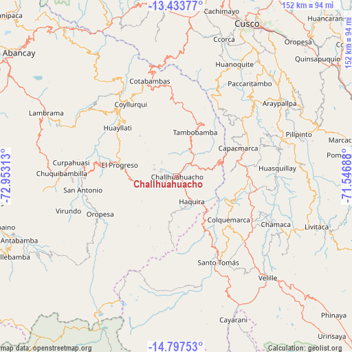
Challhuahuacho GPS coordinates[2]
14° 7' 0.012" South, 72° 15' 0" West
| Map corner | latitude | longitude |
|---|---|---|
| Upper-left | -13.43377°, | -72.95313° |
| Center: | -14.11667°, | -72.25° |
| Lower-right: | -14.79753°, | -71.54688° |
| Map W x H: | 151.6×151.6 km | = 94.2×94.2mi |
| max Lat: | -0.96667° ⇑76.5% North |
| Challhuahuacho: | -14.11667° |
| min Lat: | ⇓23.5% South -18.01465° |
| min Long | Challhuahuacho | max Long |
| -81.30472° | -72.25° | -69.04167° |
| W 78.7%⇐ | ⇒21.3% E |
Elevation
Elevation of Challhuahuacho is 3716 m = 12192 ft, and this is 1397.3 m = 4584 ft above average elevation for this country.
| Max E: |
5022 m = 16476 ft | 13.5% |
| Challhuahuacho | 3716 m 12192 ft | |
| Avg. | 2318.7 m = 7607 ft | |
Min E: |
1 m = 3 ft | 86.5% |
See also: Peru elevation on elevation.city.
Geographical zone
Challhuahuacho is located in South Torrid zone (between Equator and Tropic of Capricorn). Distance of this Southern Tropic circle is 1036.3 km =643.9 mi to South.| Distance of | km | miles | from Challhuahuacho |
|---|---|---|---|
| Equator | 1569.6 | 975.3 | to North |
| Tropic Capricorn | 1036.3 | 643.9 | to South |
| Antarctic Circle | 5831.5 | 3623.5 | to South |
| South Pole | 8437.4 | 5242.8 | to South |


Nearby cities:
15 places around Challhuahuacho: (largest is in red/bold)
• Ayrihuanca
39.1 km =24.3 mi,  271°
271°
• Capacmarca
29.7 km =18.5 mi,  66°
66°
• Ccapi
34.7 km =21.6 mi,  32°
32°
• Colquemarca
29 km =18 mi,  129°
129°
• Coyllurqui
36.8 km =22.9 mi,  327°
327°
• Haquira
12.5 km =7.8 mi,  148°
148°
• Huayllati
32.8 km =20.4 mi,  309°
309°
• Llusco
27.9 km =17.3 mi, 148°
• Mamara
38.3 km =23.8 mi,  250°
250°
• Mara
15.7 km =9.8 mi,  77°
77°
• Oropesa
36.4 km =22.6 mi,  244°
244°
• Palpacachi
38.8 km =24.1 mi,  315°
315°
• Progreso
24.5 km =15.2 mi,  281°
281°
• Quiñota
24.5 km =15.2 mi, 149°
• Tambobamba
20.9 km =13 mi,  23°
23°
Sources, notices
• [Note1] Compared only with cities in Peru existing in our database
• [Src1] Map data: © OpenStreetMap contributors (CC-BY-SA)
• [Src2] Other city data from geonames.org with taken over terms of usage.
• [Src3] Geographical zone / Annual Mean Temperature by Robert A. Rohde @ Wikipedia
