Accomarca geodata
Accomarca (Ayacucho) is a seat of a third-order administrative division; located in Peru in America/Lima (GMT-5) time zone. In our database, there are 305 cities with bigger population. Compared to other cities in Peru, 71.4% of cities are located further ↑North; 67% of cities are located further ←West and 71.9% of cities have lower elevation than Accomarca. Note1
Administrative division(s):
- Level 1: Ayacucho
- Level 2: Provincia de Vilcas Huamán
- Level 3: Accomarca


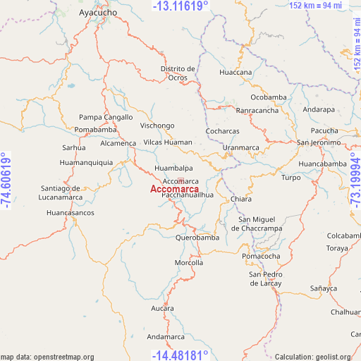
Accomarca GPS coordinates[2]
13° 48' 0" South, 73° 54' 11.016" West
| Map corner | latitude | longitude |
|---|---|---|
| Upper-left | -13.11619°, | -74.60619° |
| Center: | -13.8°, | -73.90306° |
| Lower-right: | -14.48181°, | -73.19994° |
| Map W x H: | 151.8×151.8 km | = 94.3×94.3mi |
| max Lat: | -0.96667° ⇑71.4% North |
| Accomarca: | -13.8° |
| min Lat: | ⇓28.6% South -18.01465° |
| min Long | Accomarca | max Long |
| -81.30472° | -73.90306° | -69.04167° |
| W 67%⇐ | ⇒33% E |
Elevation
Elevation of Accomarca is 3381 m = 11093 ft, and this is 1062.3 m = 3485 ft above average elevation for this country.
| Max E: |
5022 m = 16476 ft | 28.1% |
| Accomarca | 3381 m 11093 ft | |
| Avg. | 2318.7 m = 7607 ft | |
Min E: |
1 m = 3 ft | 71.9% |
See also: Peru elevation on elevation.city.
Geographical zone
Accomarca is located in South Torrid zone (between Equator and Tropic of Capricorn). Distance of this Southern Tropic circle is 1071.5 km =665.8 mi to South.| Distance of | km | miles | from Accomarca |
|---|---|---|---|
| Equator | 1534.4 | 953.4 | to North |
| Tropic Capricorn | 1071.5 | 665.8 | to South |
| Antarctic Circle | 5866.8 | 3645.5 | to South |
| South Pole | 8472.6 | 5264.6 | to South |


Nearby cities:
15 places around Accomarca: (largest is in red/bold)
• Apongo
24.1 km =15 mi,  187°
187°
• Asquipata
28.4 km =17.6 mi,  181°
181°
• Canaria
13.5 km =8.4 mi, 181°
• Cangallo
32.2 km =20 mi,  306°
306°
• Carhuanca
13.9 km =8.6 mi,  62°
62°
• Cayara
9.3 km =5.8 mi,  273°
273°
• Chalcos
17 km =10.6 mi,  108°
108°
• Chiara
26.6 km =16.5 mi, 106°
• Cocharcas
27.5 km =17.1 mi,  39°
39°
• Colca
16.9 km =10.5 mi,  304°
304°
• Huambalpa
6.4 km =4 mi,  331°
331°
• Huancapi
18.3 km =11.4 mi,  285°
285°
• Querobamba
24.7 km =15.3 mi,  163°
163°
• Saurama
19.6 km =12.2 mi,  52°
52°
• Vischongo
25.4 km =15.8 mi,  337°
337°
Sources, notices
• [Note1] Compared only with cities in Peru existing in our database
• [Src1] Map data: © OpenStreetMap contributors (CC-BY-SA)
• [Src2] Other city data from geonames.org with taken over terms of usage.
• [Src3] Geographical zone / Annual Mean Temperature by Robert A. Rohde @ Wikipedia
