Huancapi geodata
Huancapi (Ayacucho) is a seat of a third-order administrative division; located in Peru in America/Lima (GMT-5) time zone. In our database, there are 305 cities with bigger population. Compared to other cities in Peru, 70.9% of cities are located further ↑North; 65.5% of cities are located further ←West and 60.9% of cities have lower elevation than Huancapi. Note1
Administrative division(s):
- Level 1: Ayacucho
- Level 2: Provincia de Víctor Fajardo
- Level 3: Huancapi


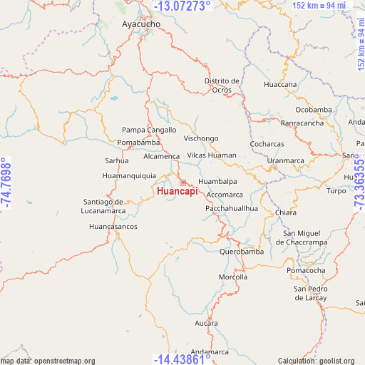
Huancapi GPS coordinates[2]
13° 45' 24.012" South, 74° 4' 0.012" West
| Map corner | latitude | longitude |
|---|---|---|
| Upper-left | -13.07273°, | -74.7698° |
| Center: | -13.75667°, | -74.06667° |
| Lower-right: | -14.43861°, | -73.36355° |
| Map W x H: | 151.9×151.9 km | = 94.4×94.4mi |
| max Lat: | -0.96667° ⇑70.9% North |
| Huancapi: | -13.75667° |
| min Lat: | ⇓29.1% South -18.01465° |
| min Long | Huancapi | max Long |
| -81.30472° | -74.06667° | -69.04167° |
| W 65.5%⇐ | ⇒34.5% E |
Elevation
Elevation of Huancapi is 3178 m = 10427 ft, and this is 859.3 m = 2819 ft above average elevation for this country.
| Max E: |
5022 m = 16476 ft | 39.1% |
| Huancapi | 3178 m 10427 ft | |
| Avg. | 2318.7 m = 7607 ft | |
Min E: |
1 m = 3 ft | 60.9% |
See also: Peru elevation on elevation.city.
Geographical zone
Huancapi is located in South Torrid zone (between Equator and Tropic of Capricorn). Distance of this Southern Tropic circle is 1076.3 km =668.8 mi to South.| Distance of | km | miles | from Huancapi |
|---|---|---|---|
| Equator | 1529.6 | 950.4 | to North |
| Tropic Capricorn | 1076.3 | 668.8 | to South |
| Antarctic Circle | 5871.6 | 3648.4 | to South |
| South Pole | 8477.5 | 5267.7 | to South |


Nearby cities:
15 places around Huancapi: (largest is in red/bold)
• Accomarca
18.3 km =11.4 mi,  105°
105°
• Apongo
32.1 km =19.9 mi,  153°
153°
• Canaria
25.3 km =15.7 mi,  136°
136°
• Cangallo
16.5 km =10.3 mi,  329°
329°
• Carapo
28 km =17.4 mi,  250°
250°
• Carhuanca
30.1 km =18.7 mi,  86°
86°
• Cayara
9.4 km =5.8 mi,  116°
116°
• Colca
5.9 km =3.7 mi,  37°
37°
• Huamanquiquia
22.5 km =14 mi,  277°
277°
• Huambalpa
14.7 km =9.1 mi, 86°
• Pampa Cangallo
26 km =16.2 mi, 327°
• Pomabamba
24.9 km =15.5 mi,  312°
312°
• Sacsamarca
33.8 km =21 mi,  231°
231°
• Sarhua
28.9 km =18 mi,  288°
288°
• Vischongo
20.2 km =12.6 mi,  22°
22°
Sources, notices
• [Note1] Compared only with cities in Peru existing in our database
• [Src1] Map data: © OpenStreetMap contributors (CC-BY-SA)
• [Src2] Other city data from geonames.org with taken over terms of usage.
• [Src3] Geographical zone / Annual Mean Temperature by Robert A. Rohde @ Wikipedia
