Chignayhua geodata
Chignayhua (Cusco) is a populated place; located in Peru in America/Lima (GMT-5) time zone. With population of 3,912 people, there are 275 cities with bigger population in this country. Compared to other cities in Peru, 79.2% of cities are located further ↑North; 86.5% of cities are located further ←West and 92.4% of cities have lower elevation than Chignayhua. Note1


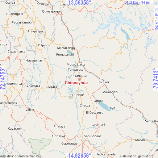
Chignayhua GPS coordinates[2]
14° 14' 45.96" South, 71° 26' 39.912" West
| Map corner | latitude | longitude |
|---|---|---|
| Upper-left | -13.56358°, | -72.14755° |
| Center: | -14.2461°, | -71.44442° |
| Lower-right: | -14.92656°, | -70.7413° |
| Map W x H: | 151.5×151.6 km | = 94.1×94.2mi |
| max Lat: | -0.96667° ⇑79.2% North |
| Chignayhua: | -14.2461° |
| min Lat: | ⇓20.8% South -18.01465° |
| min Long | Chignayhua | max Long |
| -81.30472° | -71.44442° | -69.04167° |
| W 86.5%⇐ | ⇒13.5% E |
Elevation
Elevation of Chignayhua is 3917 m = 12851 ft, and this is 1598.3 m = 5244 ft above average elevation for this country.
| Max E: |
5022 m = 16476 ft | 7.6% |
| Chignayhua | 3917 m 12851 ft | |
| Avg. | 2318.7 m = 7607 ft | |
Min E: |
1 m = 3 ft | 92.4% |
See also: Peru elevation on elevation.city.
Geographical zone
Chignayhua is located in South Torrid zone (between Equator and Tropic of Capricorn). Distance of this Southern Tropic circle is 1021.9 km =635 mi to South.| Distance of | km | miles | from Chignayhua |
|---|---|---|---|
| Equator | 1584 | 984.3 | to North |
| Tropic Capricorn | 1021.9 | 635 | to South |
| Antarctic Circle | 5817.2 | 3614.6 | to South |
| South Pole | 8423 | 5233.8 | to South |


Nearby cities:
15 places around Chignayhua: (largest is in red/bold)
• Cahuanuyo
10.8 km =6.7 mi,  190°
190°
• Ccaquiracunca
3.5 km =2.2 mi, 190°
• Ccuntuma
13.9 km =8.6 mi,  14°
14°
• Combapata
16.2 km =10.1 mi, 5°
• Jayobamba
20.3 km =12.6 mi,  33°
33°
• Lima Pampa
20.9 km =13 mi, 33°
• Mosoc Llacta
14.4 km =8.9 mi,  347°
347°
• Pampamarca
11.2 km =7 mi, 351°
• Quehue
14.9 km =9.3 mi,  184°
184°
• Queromarca
9.5 km =5.9 mi,  43°
43°
• San Pablo
14.7 km =9.1 mi,  70°
70°
• San Pedro
12.9 km =8 mi,  59°
59°
• Tinta
11.9 km =7.4 mi,  19°
19°
• Tungasuca
9.8 km =6.1 mi,  339°
339°
• Yanaoca
3.4 km =2.1 mi, 23°
Sources, notices
• [Note1] Compared only with cities in Peru existing in our database
• [Src1] Map data: © OpenStreetMap contributors (CC-BY-SA)
• [Src2] Other city data from geonames.org with taken over terms of usage.
• [Src3] Geographical zone / Annual Mean Temperature by Robert A. Rohde @ Wikipedia
