Jayobamba geodata
Jayobamba (Cusco) is a populated place; located in Peru in America/Lima (GMT-5) time zone. With population of 3,593 people, there are 282 cities with bigger population in this country. Compared to other cities in Peru, 75.9% of cities are located further ↑North; 87.9% of cities are located further ←West and 82.7% of cities have lower elevation than Jayobamba. Note1


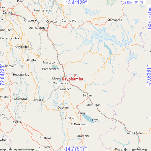
Jayobamba GPS coordinates[2]
14° 5' 39.3" South, 71° 20' 21.192" West
| Map corner | latitude | longitude |
|---|---|---|
| Upper-left | -13.41129°, | -72.04235° |
| Center: | -14.09425°, | -71.33922° |
| Lower-right: | -14.77517°, | -70.6361° |
| Map W x H: | 151.6×151.7 km | = 94.2×94.3mi |
| max Lat: | -0.96667° ⇑75.9% North |
| Jayobamba: | -14.09425° |
| min Lat: | ⇓24.1% South -18.01465° |
| min Long | Jayobamba | max Long |
| -81.30472° | -71.33922° | -69.04167° |
| W 87.9%⇐ | ⇒12.1% E |
Elevation
Elevation of Jayobamba is 3583 m = 11755 ft, and this is 1264.3 m = 4148 ft above average elevation for this country.
| Max E: |
5022 m = 16476 ft | 17.3% |
| Jayobamba | 3583 m 11755 ft | |
| Avg. | 2318.7 m = 7607 ft | |
Min E: |
1 m = 3 ft | 82.7% |
See also: Peru elevation on elevation.city.
Geographical zone
Jayobamba is located in South Torrid zone (between Equator and Tropic of Capricorn). Distance of this Southern Tropic circle is 1038.8 km =645.5 mi to South.| Distance of | km | miles | from Jayobamba |
|---|---|---|---|
| Equator | 1567.1 | 973.8 | to North |
| Tropic Capricorn | 1038.8 | 645.5 | to South |
| Antarctic Circle | 5834 | 3625.1 | to South |
| South Pole | 8439.9 | 5244.3 | to South |


Nearby cities:
15 places around Jayobamba: (largest is in red/bold)
• Ccuntuma
8.6 km =5.3 mi,  246°
246°
• Checacupe
14.4 km =8.9 mi,  301°
301°
• Combapata
9.8 km =6.1 mi,  265°
265°
• Cullcuyre
0.9 km =0.6 mi,  78°
78°
• Lima Pampa
0.6 km =0.4 mi,  29°
29°
• Mosoc Llacta
14.7 km =9.1 mi,  258°
258°
• Pampamarca
14.2 km =8.8 mi, 245°
• Pitumarca
15.6 km =9.7 mi,  330°
330°
• Qquea
6.7 km =4.2 mi,  311°
311°
• Queromarca
11.1 km =6.9 mi,  205°
205°
• San Pablo
12.3 km =7.6 mi,  168°
168°
• San Pedro
10.3 km =6.4 mi,  181°
181°
• Tinta
9.2 km =5.7 mi,  232°
232°
• Tungasuca
16.7 km =10.4 mi,  242°
242°
• Yanaoca
17 km =10.6 mi,  215°
215°
Sources, notices
• [Note1] Compared only with cities in Peru existing in our database
• [Src1] Map data: © OpenStreetMap contributors (CC-BY-SA)
• [Src2] Other city data from geonames.org with taken over terms of usage.
• [Src3] Geographical zone / Annual Mean Temperature by Robert A. Rohde @ Wikipedia
