Qquea geodata
Qquea (Cusco) is a populated place; located in Peru in America/Lima (GMT-5) time zone. With population of 3,482 people, there are 288 cities with bigger population in this country. Compared to other cities in Peru, 74.8% of cities are located further ↑North; 87.3% of cities are located further ←West and 99.1% of cities have lower elevation than Qquea. Note1


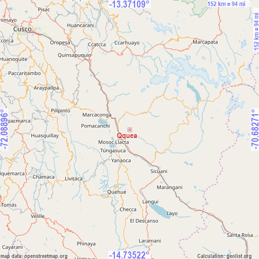
Qquea GPS coordinates[2]
14° 3' 15.012" South, 71° 23' 8.988" West
| Map corner | latitude | longitude |
|---|---|---|
| Upper-left | -13.37109°, | -72.08896° |
| Center: | -14.05417°, | -71.38583° |
| Lower-right: | -14.73522°, | -70.68271° |
| Map W x H: | 151.7×151.7 km | = 94.3×94.3mi |
| max Lat: | -0.96667° ⇑74.8% North |
| Qquea: | -14.05417° |
| min Lat: | ⇓25.2% South -18.01465° |
| min Long | Qquea | max Long |
| -81.30472° | -71.38583° | -69.04167° |
| W 87.3%⇐ | ⇒12.7% E |
Elevation
Elevation of Qquea is 4470 m = 14665 ft, and this is 2151.3 m = 7058 ft above average elevation for this country.
| Max E: |
5022 m = 16476 ft | 0.90000000000001% |
| Qquea | 4470 m 14665 ft | |
| Avg. | 2318.7 m = 7607 ft | |
Min E: |
1 m = 3 ft | 99.1% |
See also: Peru elevation on elevation.city.
Geographical zone
Qquea is located in South Torrid zone (between Equator and Tropic of Capricorn). Distance of this Southern Tropic circle is 1043.2 km =648.2 mi to South.| Distance of | km | miles | from Qquea |
|---|---|---|---|
| Equator | 1562.7 | 971 | to North |
| Tropic Capricorn | 1043.2 | 648.2 | to South |
| Antarctic Circle | 5838.5 | 3627.9 | to South |
| South Pole | 8444.4 | 5247.1 | to South |


Nearby cities:
15 places around Qquea: (largest is in red/bold)
• Ccuntuma
8.4 km =5.2 mi,  199°
199°
• Checacupe
7.8 km =4.8 mi,  292°
292°
• Combapata
7 km =4.3 mi,  222°
222°
• Cullcuyre
7.3 km =4.5 mi,  126°
126°
• Jayobamba
6.7 km =4.2 mi, 131°
• Lima Pampa
6.6 km =4.1 mi, 126°
• Mosoc Llacta
11.9 km =7.4 mi,  232°
232°
• Pampamarca
13 km =8.1 mi, 217°
• Pitumarca
9.5 km =5.9 mi,  344°
344°
• Queromarca
14.4 km =8.9 mi,  178°
178°
• San Pablo
18.2 km =11.3 mi,  155°
155°
• San Pedro
15.5 km =9.6 mi, 162°
• Tinta
10.4 km =6.5 mi,  192°
192°
• Tungasuca
15.6 km =9.7 mi, 218°
• Yanaoca
18.9 km =11.7 mi, 195°
Sources, notices
• [Note1] Compared only with cities in Peru existing in our database
• [Src1] Map data: © OpenStreetMap contributors (CC-BY-SA)
• [Src2] Other city data from geonames.org with taken over terms of usage.
• [Src3] Geographical zone / Annual Mean Temperature by Robert A. Rohde @ Wikipedia
