Checacupe geodata
Checacupe (Cusco) is a seat of a third-order administrative division; located in Peru in America/Lima (GMT-5) time zone. With population of 3,440 people, there are 291 cities with bigger population in this country. Compared to other cities in Peru, 74.4% of cities are located further ↑North; 86.1% of cities are located further ←West and 75.8% of cities have lower elevation than Checacupe. Note1


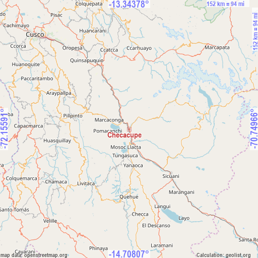
Checacupe GPS coordinates[2]
14° 1' 36.984" South, 71° 27' 10.008" West
| Map corner | latitude | longitude |
|---|---|---|
| Upper-left | -13.34378°, | -72.15591° |
| Center: | -14.02694°, | -71.45278° |
| Lower-right: | -14.70807°, | -70.74966° |
| Map W x H: | 151.7×151.7 km | = 94.3×94.3mi |
| max Lat: | -0.96667° ⇑74.4% North |
| Checacupe: | -14.02694° |
| min Lat: | ⇓25.6% South -18.01465° |
| min Long | Checacupe | max Long |
| -81.30472° | -71.45278° | -69.04167° |
| W 86.1%⇐ | ⇒13.9% E |
Elevation
Elevation of Checacupe is 3445 m = 11302 ft, and this is 1126.3 m = 3695 ft above average elevation for this country.
| Max E: |
5022 m = 16476 ft | 24.2% |
| Checacupe | 3445 m 11302 ft | |
| Avg. | 2318.7 m = 7607 ft | |
Min E: |
1 m = 3 ft | 75.8% |
See also: Peru elevation on elevation.city.
Geographical zone
Checacupe is located in South Torrid zone (between Equator and Tropic of Capricorn). Distance of this Southern Tropic circle is 1046.3 km =650.1 mi to South.| Distance of | km | miles | from Checacupe |
|---|---|---|---|
| Equator | 1559.6 | 969.1 | to North |
| Tropic Capricorn | 1046.3 | 650.1 | to South |
| Antarctic Circle | 5841.5 | 3629.7 | to South |
| South Pole | 8447.4 | 5249 | to South |


Nearby cities:
15 places around Checacupe: (largest is in red/bold)
• Ccuntuma
11.8 km =7.3 mi,  158°
158°
• Combapata
8.6 km =5.3 mi, 163°
• Cullcuyre
15 km =9.3 mi,  119°
119°
• Cusipata
14.2 km =8.8 mi,  339°
339°
• Jayobamba
14.4 km =8.9 mi, 121°
• Lima Pampa
14.3 km =8.9 mi, 119°
• Mosoc Llacta
10.6 km =6.6 mi,  191°
191°
• Pampamarca
13.3 km =8.3 mi,  183°
183°
• Pitumarca
7.6 km =4.7 mi,  37°
37°
• Pomacanchi
12.3 km =7.6 mi,  270°
270°
• Qquea
7.8 km =4.8 mi,  112°
112°
• Queromarca
19 km =11.8 mi, 156°
• San Pedro
21.4 km =13.3 mi,  145°
145°
• Tinta
14 km =8.7 mi, 159°
• Tungasuca
15.4 km =9.6 mi, 189°
Sources, notices
• [Note1] Compared only with cities in Peru existing in our database
• [Src1] Map data: © OpenStreetMap contributors (CC-BY-SA)
• [Src2] Other city data from geonames.org with taken over terms of usage.
• [Src3] Geographical zone / Annual Mean Temperature by Robert A. Rohde @ Wikipedia
