Collonce geodata
Collonce (Amazonas) is a seat of a third-order administrative division; located in Peru in America/Lima (GMT-5) time zone. In our database, there are 305 cities with bigger population. Compared to other cities in Peru, 87.5% of cities are located further ↓South; 83.4% of cities are located further →East and 67.3% of cities have higher elevation than Collonce. Note1


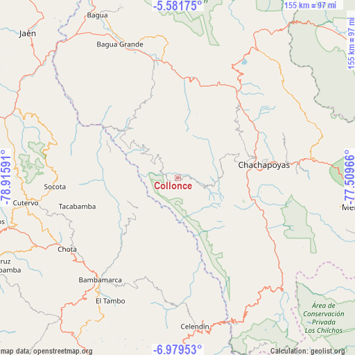
Collonce GPS coordinates[2]
6° 16' 51.996" South, 78° 12' 46.008" West
| Map corner | latitude | longitude |
|---|---|---|
| Upper-left | -5.58175°, | -78.91591° |
| Center: | -6.28111°, | -78.21278° |
| Lower-right: | -6.97953°, | -77.50966° |
| Map W x H: | 155.4×155.4 km | = 96.6×96.6mi |
| max Lat: | -0.96667° ⇑12.5% North |
| Collonce: | -6.28111° |
| min Lat: | ⇓87.5% South -18.01465° |
| min Long | Collonce | max Long |
| -81.30472° | -78.21278° | -69.04167° |
| W 16.6%⇐ | ⇒83.4% E |
Elevation
Elevation of Collonce is 1834 m = 6017 ft, and this is 484.7 m = 1590 ft below average elevation for this country.
| Max E: |
5022 m = 16476 ft | 67.3% |
| Avg. | 2318.7 m = 7607 ft | |
| Collonce | 1834 m = 6017 ft | |
Min E: |
1 m = 3 ft | 32.7% |
See also: Peru elevation on elevation.city.
Geographical zone
Collonce is located in South Torrid zone (between Equator and Tropic of Capricorn). Distance of Equator is 698.4 km =434 mi to North.| Distance of | km | miles | from Collonce |
|---|---|---|---|
| Equator | 698.4 | 434 | to North |
| Tropic Capricorn | 1907.5 | 1185.3 | to South |
| Antarctic Circle | 6702.8 | 4164.9 | to South |
| South Pole | 9308.7 | 5784.2 | to South |


Nearby cities:
15 places around Collonce: (largest is in red/bold)
• Choropampa
23.1 km =14.4 mi,  221°
221°
• Chumuch
35.5 km =22.1 mi,  180°
180°
• Colcamar
26.6 km =16.5 mi,  94°
94°
• Inguilpata
28.6 km =17.8 mi,  80°
80°
• Lamud
32.8 km =20.4 mi,  60°
60°
• Levanto
34.9 km =21.7 mi, 94°
• Longuita
30.8 km =19.1 mi,  118°
118°
• Lonya Chico
28.9 km =18 mi, 78°
• Lonya Grande
31 km =19.3 mi,  311°
311°
• Luya
32.3 km =20.1 mi,  66°
66°
• Olto
34.3 km =21.3 mi,  54°
54°
• Paccha
33.1 km =20.6 mi, 223°
• Providencia
3.5 km =2.2 mi,  238°
238°
• Santa Catalina
25.2 km =15.7 mi,  41°
41°
• Tingo
34.7 km =21.6 mi,  106°
106°
Sources, notices
• [Note1] Compared only with cities in Peru existing in our database
• [Src1] Map data: © OpenStreetMap contributors (CC-BY-SA)
• [Src2] Other city data from geonames.org with taken over terms of usage.
• [Src3] Geographical zone / Annual Mean Temperature by Robert A. Rohde @ Wikipedia
