Urpay geodata
Urpay (La Libertad) is a seat of a third-order administrative division; located in Peru in America/Lima (GMT-5) time zone. In our database, there are 305 cities with bigger population. Compared to other cities in Peru, 71.8% of cities are located further ↓South; 71.2% of cities are located further →East and 54.6% of cities have higher elevation than Urpay. Note1


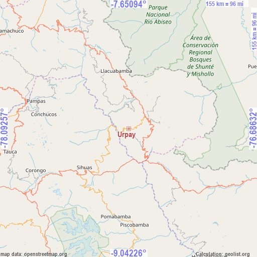
Urpay GPS coordinates[2]
8° 20' 49.992" South, 77° 23' 21.984" West
| Map corner | latitude | longitude |
|---|---|---|
| Upper-left | -7.65094°, | -78.09257° |
| Center: | -8.34722°, | -77.38944° |
| Lower-right: | -9.04226°, | -76.68632° |
| Map W x H: | 154.7×154.7 km | = 96.1×96.1mi |
| max Lat: | -0.96667° ⇑28.2% North |
| Urpay: | -8.34722° |
| min Lat: | ⇓71.8% South -18.01465° |
| min Long | Urpay | max Long |
| -81.30472° | -77.38944° | -69.04167° |
| W 28.8%⇐ | ⇒71.2% E |
Elevation
Elevation of Urpay is 2693 m = 8835 ft, and this is 374.3 m = 1228 ft above average elevation for this country.
| Max E: |
5022 m = 16476 ft | 54.6% |
| Urpay | 2693 m 8835 ft | |
| Avg. | 2318.7 m = 7607 ft | |
Min E: |
1 m = 3 ft | 45.4% |
See also: Peru elevation on elevation.city.
Geographical zone
Urpay is located in South Torrid zone (between Equator and Tropic of Capricorn). Distance of Equator is 928.1 km =576.7 mi to North.| Distance of | km | miles | from Urpay |
|---|---|---|---|
| Equator | 928.1 | 576.7 | to North |
| Tropic Capricorn | 1677.8 | 1042.5 | to South |
| Antarctic Circle | 6473.1 | 4022.2 | to South |
| South Pole | 9078.9 | 5641.4 | to South |


Nearby cities:
15 places around Urpay: (largest is in red/bold)
• Challas
12.7 km =7.9 mi,  143°
143°
• Chillia
29.4 km =18.3 mi,  339°
339°
• Conchucos
51.5 km =32 mi,  280°
280°
• Huacrachuco
47.6 km =29.6 mi, 135°
• Huancaspata
15.8 km =9.8 mi, 140°
• Huaylillas
18.5 km =11.5 mi,  16°
16°
• Parcoy
36.2 km =22.5 mi, 344°
• Pomabamba
54.7 km =34 mi,  188°
188°
• Quiches
12.4 km =7.7 mi,  244°
244°
• Quinuabamba
43 km =26.7 mi,  176°
176°
• Sihuas
34.9 km =21.7 mi,  225°
225°
• Sitabamba
51.5 km =32 mi,  312°
312°
• Taurija
5.6 km =3.5 mi,  320°
320°
• Tayabamba
12.9 km =8 mi,  52°
52°
• Ullulluco
12.7 km =7.9 mi,  198°
198°
Sources, notices
• [Note1] Compared only with cities in Peru existing in our database
• [Src1] Map data: © OpenStreetMap contributors (CC-BY-SA)
• [Src2] Other city data from geonames.org with taken over terms of usage.
• [Src3] Geographical zone / Annual Mean Temperature by Robert A. Rohde @ Wikipedia
