Challas geodata
Challas (La Libertad) is a seat of a third-order administrative division; located in Peru in America/Lima (GMT-5) time zone. In our database, there are 305 cities with bigger population. Compared to other cities in Peru, 71.3% of cities are located further ↓South; 70.7% of cities are located further →East and 67.3% of cities have lower elevation than Challas. Note1
Administrative division(s):
- Level 1: La Libertad
- Level 2: Provincia de Pataz
- Level 3: Santiago De Challas


Challas GPS coordinates[2]
8° 26' 17.988" South, 77° 19' 14.016" West
| Map corner | latitude | longitude |
|---|---|---|
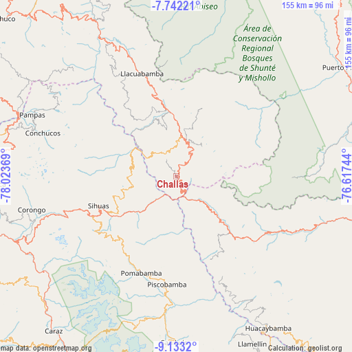
| Upper-left | -7.74221°, | -78.02369° |
| Center: | -8.43833°, | -77.32056° |
| Lower-right: | -9.1332°, | -76.61744° |
| Map W x H: | 154.7×154.7 km | = 96.1×96.1mi |
| max Lat: | -0.96667° ⇑28.7% North |
| Challas: | -8.43833° |
| min Lat: | ⇓71.3% South -18.01465° |
| min Long | Challas | max Long |
| -81.30472° | -77.32056° | -69.04167° |
| W 29.3%⇐ | ⇒70.7% E |
Elevation
Elevation of Challas is 3296 m = 10814 ft, and this is 977.3 m = 3206 ft above average elevation for this country.
| Max E: |
5022 m = 16476 ft | 32.7% |
| Challas | 3296 m 10814 ft | |
| Avg. | 2318.7 m = 7607 ft | |
Min E: |
1 m = 3 ft | 67.3% |
See also: Peru elevation on elevation.city.
Geographical zone
Challas is located in South Torrid zone (between Equator and Tropic of Capricorn). Distance of Equator is 938.3 km =583 mi to North.| Distance of | km | miles | from Challas |
|---|---|---|---|
| Equator | 938.3 | 583 | to North |
| Tropic Capricorn | 1667.7 | 1036.3 | to South |
| Antarctic Circle | 6462.9 | 4015.9 | to South |
| South Pole | 9068.8 | 5635.1 | to South |


Nearby cities:
15 places around Challas: (largest is in red/bold)
• Chillia
41.7 km =25.9 mi,  334°
334°
• Huacrachuco
35.1 km =21.8 mi,  132°
132°
• Huancaspata
3.2 km =2 mi, 129°
• Huaylillas
28 km =17.4 mi,  355°
355°
• Llama
49.5 km =30.8 mi,  177°
177°
• Lucma
54.2 km =33.7 mi,  191°
191°
• Parcoy
48.2 km =30 mi,  338°
338°
• Pomabamba
46.8 km =29.1 mi,  200°
200°
• Quiches
19.3 km =12 mi,  284°
284°
• Quinuabamba
33.2 km =20.6 mi, 188°
• Sihuas
35.6 km =22.1 mi,  246°
246°
• Taurija
18.2 km =11.3 mi,  322°
322°
• Tayabamba
18.1 km =11.2 mi,  8°
8°
• Ullulluco
11.8 km =7.3 mi,  260°
260°
• Urpay
12.7 km =7.9 mi, 323°
Sources, notices
• [Note1] Compared only with cities in Peru existing in our database
• [Src1] Map data: © OpenStreetMap contributors (CC-BY-SA)
• [Src2] Other city data from geonames.org with taken over terms of usage.
• [Src3] Geographical zone / Annual Mean Temperature by Robert A. Rohde @ Wikipedia
