Tignoan geodata
Tignoan (Calabarzon) is a populated place; located in Philippines in Asia/Manila (GMT+8) time zone. With population of 4,164 people, there are 1636 cities with bigger population in this country. Compared to other cities in Philippines, 74.4% of cities are located further ↓South; 65.1% of cities are located further →East and 67.4% of cities have higher elevation than Tignoan. Note1


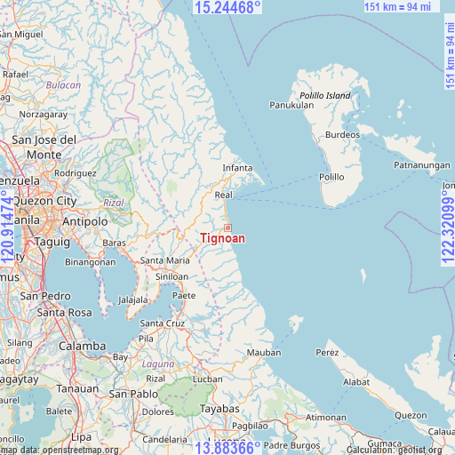
Tignoan GPS coordinates[2]
14° 33' 54.792" North, 121° 37' 4.296" East
| Map corner | latitude | longitude |
|---|---|---|
| Upper-left | 15.24468°, | 120.91474° |
| Center: | 14.56522°, | 121.61786° |
| Lower-right: | 13.88366°, | 122.32099° |
| Map W x H: | 151.3×151.3 km | = 94×94mi |
| max Lat: | 20.78733° ⇑25.6% North |
| Tignoan: | 14.56522° |
| min Lat: | ⇓74.4% South 4.65442° |
| min Long | Tignoan | max Long |
| 117.04868° | 121.61786° | 126.58417° |
| W 34.9%⇐ | ⇒65.1% E |
Elevation
Elevation of Tignoan is 13 m = 43 ft, and this is 74.9 m = 246 ft below average elevation for this country.
| Max E: |
2262 m = 7421 ft | 67.4% |
| Avg. | 87.9 m = 288 ft | |
| Tignoan | 13 m = 43 ft | |
Min E: |
-2 m = -7 ft | 32.6% |
See also: Philippines elevation on elevation.city.
Geographical zone
Tignoan is located in North Torrid zone (between Equator and Tropic of Cancer). Distance of this Northern Tropic circle is 986.4 km =612.9 mi to North.| Distance of | km | miles | from Tignoan |
|---|---|---|---|
| North Pole | 8387.6 | 5211.8 | to North |
| Arctic Circle | 5781.7 | 3592.6 | to North |
| Tropic Cancer | 986.4 | 612.9 | to North |
| Equator | 1619.5 | 1006.3 | to South |


Nearby cities:
15 places around Tignoan: (largest is in red/bold)
• Bantilan
22.1 km =13.7 mi,  14°
14°
• Banugao
20.4 km =12.7 mi,  0°
0°
• Binulasan
20.4 km =12.7 mi,  24°
24°
• Daraitan
20.4 km =12.7 mi,  281°
281°
• Dinahican
19.9 km =12.4 mi,  32°
32°
• Famy
23.1 km =14.4 mi,  232°
232°
• General Nakar
22.1 km =13.7 mi, 4°
• Gumian
16.1 km =10 mi, 0°
• Infanta
20.3 km =12.6 mi, 9°
• Kapatalan
17.1 km =10.6 mi, 233°
• Kiloloran
7.9 km =4.9 mi,  350°
350°
• Pangil
24.4 km =15.2 mi,  222°
222°
• Pulo
16.7 km =10.4 mi, 5°
• Real
11.1 km =6.9 mi, 352°
• Santa Maria
22.9 km =14.2 mi,  243°
243°
Sources, notices
• [Note1] Compared only with cities in Philippines existing in our database
• [Src1] Map data: © OpenStreetMap contributors (CC-BY-SA)
• [Src2] Other city data from geonames.org with taken over terms of usage.
• [Src3] Geographical zone / Annual Mean Temperature by Robert A. Rohde @ Wikipedia
