Real geodata
Real (Calabarzon) is a populated place; located in Philippines in Asia/Manila (GMT+8) time zone. With population of 9,163 people, there are 672 cities with bigger population in this country. Compared to other cities in Philippines, 74.9% of cities are located further ↓South; 65.4% of cities are located further →East and 92.7% of cities have higher elevation than Real. Note1


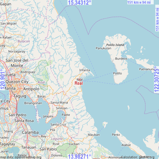
Real GPS coordinates[2]
14° 39' 50.292" North, 121° 36' 14.832" East
| Map corner | latitude | longitude |
|---|---|---|
| Upper-left | 15.34312°, | 120.901° |
| Center: | 14.66397°, | 121.60412° |
| Lower-right: | 13.98271°, | 122.30725° |
| Map W x H: | 151.3×151.3 km | = 94×94mi |
| max Lat: | 20.78733° ⇑25.1% North |
| Real: | 14.66397° |
| min Lat: | ⇓74.9% South 4.65442° |
| min Long | Real | max Long |
| 117.04868° | 121.60412° | 126.58417° |
| W 34.6%⇐ | ⇒65.4% E |
Elevation
Elevation of Real is 6 m = 20 ft, and this is 81.9 m = 269 ft below average elevation for this country.
| Max E: |
2262 m = 7421 ft | 92.7% |
| Avg. | 87.9 m = 288 ft | |
| Real | 6 m = 20 ft | |
Min E: |
-2 m = -7 ft | 7.3% |
See also: Philippines elevation on elevation.city.
Geographical zone
Real is located in North Torrid zone (between Equator and Tropic of Cancer). Distance of this Northern Tropic circle is 975.4 km =606.1 mi to North.| Distance of | km | miles | from Real |
|---|---|---|---|
| North Pole | 8376.6 | 5205 | to North |
| Arctic Circle | 5770.7 | 3585.7 | to North |
| Tropic Cancer | 975.4 | 606.1 | to North |
| Equator | 1630.5 | 1013.1 | to South |


Nearby cities:
15 places around Real: (largest is in red/bold)
• Bantilan
12.6 km =7.8 mi,  33°
33°
• Banugao
9.5 km =5.9 mi,  9°
9°
• Binulasan
12.6 km =7.8 mi,  53°
53°
• Daraitan
19.7 km =12.2 mi,  249°
249°
• Dinahican
13.4 km =8.3 mi,  64°
64°
• Famy
30.3 km =18.8 mi,  213°
213°
• General Nakar
11.6 km =7.2 mi,  16°
16°
• Gumian
5.4 km =3.4 mi, 16°
• Infanta
10.2 km =6.3 mi, 28°
• Kapatalan
24.4 km =15.2 mi, 210°
• Kiloloran
3.1 km =1.9 mi,  175°
175°
• Pulo
6.4 km =4 mi, 28°
• Sampaloc
29.6 km =18.4 mi,  242°
242°
• Santa Maria
28.5 km =17.7 mi,  221°
221°
• Tignoan
11.1 km =6.9 mi,  172°
172°
Sources, notices
• [Note1] Compared only with cities in Philippines existing in our database
• [Src1] Map data: © OpenStreetMap contributors (CC-BY-SA)
• [Src2] Other city data from geonames.org with taken over terms of usage.
• [Src3] Geographical zone / Annual Mean Temperature by Robert A. Rohde @ Wikipedia
