Tariric geodata
Tariric (Bicol) is a populated place; located in Philippines in Asia/Manila (GMT+8) time zone. With population of 2,462 people, there are 3362 cities with bigger population in this country. Compared to other cities in Philippines, 62.9% of cities are located further ↓South; 57% of cities are located further ←West and 65.1% of cities have higher elevation than Tariric. Note1


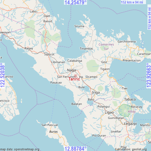
Tariric GPS coordinates[2]
13° 34' 20.28" North, 123° 13' 24.6" East
| Map corner | latitude | longitude |
|---|---|---|
| Upper-left | 14.25479°, | 122.52038° |
| Center: | 13.5723°, | 123.2235° |
| Lower-right: | 12.88784°, | 123.92663° |
| Map W x H: | 152×152 km | = 94.4×94.4mi |
| max Lat: | 20.78733° ⇑37.1% North |
| Tariric: | 13.5723° |
| min Lat: | ⇓62.9% South 4.65442° |
| min Long | Tariric | max Long |
| 117.04868° | 123.2235° | 126.58417° |
| W 57%⇐ | ⇒43% E |
Elevation
Elevation of Tariric is 14 m = 46 ft, and this is 73.9 m = 242 ft below average elevation for this country.
| Max E: |
2262 m = 7421 ft | 65.1% |
| Avg. | 87.9 m = 288 ft | |
| Tariric | 14 m = 46 ft | |
Min E: |
-2 m = -7 ft | 34.9% |
See also: Philippines elevation on elevation.city.
Geographical zone
Tariric is located in North Torrid zone (between Equator and Tropic of Cancer). Distance of this Northern Tropic circle is 1096.8 km =681.5 mi to North.| Distance of | km | miles | from Tariric |
|---|---|---|---|
| North Pole | 8498 | 5280.4 | to North |
| Arctic Circle | 5892.1 | 3661.2 | to North |
| Tropic Cancer | 1096.8 | 681.5 | to North |
| Equator | 1509.1 | 937.7 | to South |


Nearby cities:
15 places around Tariric: (largest is in red/bold)
• Antipolo
8.2 km =5.1 mi,  233°
233°
• Baliuag Nuevo
6.1 km =3.8 mi,  202°
202°
• Cadlan
4.6 km =2.9 mi,  52°
52°
• Camaligan
8.3 km =5.2 mi,  312°
312°
• Capucnasan
3.2 km =2 mi,  346°
346°
• Curry
8.8 km =5.5 mi,  69°
69°
• Himaao
8.9 km =5.5 mi,  110°
110°
• Hobo
8.4 km =5.2 mi,  214°
214°
• Marupit
8.7 km =5.4 mi, 314°
• Milaor
5.7 km =3.5 mi,  297°
297°
• Minalabac
4.3 km =2.7 mi,  264°
264°
• Naga
6.9 km =4.3 mi,  318°
318°
• Palestina
5.2 km =3.2 mi,  32°
32°
• San Agustin
4.4 km =2.7 mi,  87°
87°
• San Fernando
8.5 km =5.3 mi, 264°
Sources, notices
• [Note1] Compared only with cities in Philippines existing in our database
• [Src1] Map data: © OpenStreetMap contributors (CC-BY-SA)
• [Src2] Other city data from geonames.org with taken over terms of usage.
• [Src3] Geographical zone / Annual Mean Temperature by Robert A. Rohde @ Wikipedia
