Palestina geodata
Palestina (Bicol) is a populated place; located in Philippines in Asia/Manila (GMT+8) time zone. With population of 4,418 people, there are 1531 cities with bigger population in this country. Compared to other cities in Philippines, 63.5% of cities are located further ↓South; 57.3% of cities are located further ←West and 66.7% of cities have lower elevation than Palestina. Note1


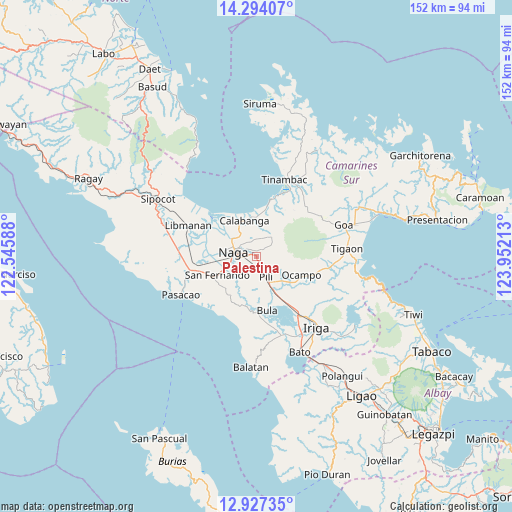
Palestina GPS coordinates[2]
13° 36' 42.12" North, 123° 14' 56.4" East
| Map corner | latitude | longitude |
|---|---|---|
| Upper-left | 14.29407°, | 122.54588° |
| Center: | 13.6117°, | 123.249° |
| Lower-right: | 12.92735°, | 123.95213° |
| Map W x H: | 152×152 km | = 94.4×94.4mi |
| max Lat: | 20.78733° ⇑36.5% North |
| Palestina: | 13.6117° |
| min Lat: | ⇓63.5% South 4.65442° |
| min Long | Palestina | max Long |
| 117.04868° | 123.249° | 126.58417° |
| W 57.3%⇐ | ⇒42.7% E |
Elevation
Elevation of Palestina is 45 m = 148 ft, and this is 42.9 m = 141 ft below average elevation for this country.
| Max E: |
2262 m = 7421 ft | 33.3% |
| Avg. | 87.9 m = 288 ft | |
| Palestina | 45 m = 148 ft | |
Min E: |
-2 m = -7 ft | 66.7% |
See also: Philippines elevation on elevation.city.
Geographical zone
Palestina is located in North Torrid zone (between Equator and Tropic of Cancer). Distance of this Northern Tropic circle is 1092.4 km =678.8 mi to North.| Distance of | km | miles | from Palestina |
|---|---|---|---|
| North Pole | 8493.6 | 5277.7 | to North |
| Arctic Circle | 5887.7 | 3658.4 | to North |
| Tropic Cancer | 1092.4 | 678.8 | to North |
| Equator | 1513.5 | 940.4 | to South |


Nearby cities:
15 places around Palestina: (largest is in red/bold)
• Cadlan
1.8 km =1.1 mi,  151°
151°
• Camaligan
9 km =5.6 mi,  277°
277°
• Canaman
9.5 km =5.9 mi,  295°
295°
• Capucnasan
3.7 km =2.3 mi,  249°
249°
• Curry
5.7 km =3.5 mi,  103°
103°
• Dugcal
9.6 km =6 mi, 278°
• Himaao
9.3 km =5.8 mi,  143°
143°
• Magarao
8.6 km =5.3 mi,  308°
308°
• Marupit
9.1 km =5.7 mi, 280°
• Milaor
8 km =5 mi,  257°
257°
• Minalabac
8.5 km =5.3 mi,  235°
235°
• Naga
7.4 km =4.6 mi, 276°
• Pili
9.5 km =5.9 mi,  50°
50°
• San Agustin
4.5 km =2.8 mi,  158°
158°
• Tariric
5.2 km =3.2 mi,  212°
212°
Sources, notices
• [Note1] Compared only with cities in Philippines existing in our database
• [Src1] Map data: © OpenStreetMap contributors (CC-BY-SA)
• [Src2] Other city data from geonames.org with taken over terms of usage.
• [Src3] Geographical zone / Annual Mean Temperature by Robert A. Rohde @ Wikipedia
