Tandoc geodata
Tandoc (Ilocos) is a populated place; located in Philippines in Asia/Manila (GMT+8) time zone. With population of 3,192 people, there are 2315 cities with bigger population in this country. Compared to other cities in Philippines, 86.9% of cities are located further ↓South; 95% of cities are located further →East and 76.6% of cities have higher elevation than Tandoc. Note1
Administrative division(s):
- Level 1: Ilocos
- Level 2: Province of Pangasinan
- Level 3: San Carlos City


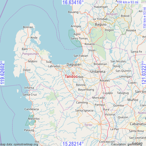
Tandoc GPS coordinates[2]
15° 57' 33.444" North, 120° 19' 44.904" East
| Map corner | latitude | longitude |
|---|---|---|
| Upper-left | 16.63416°, | 119.62602° |
| Center: | 15.95929°, | 120.32914° |
| Lower-right: | 15.28214°, | 121.03227° |
| Map W x H: | 150.3×150.3 km | = 93.4×93.4mi |
| max Lat: | 20.78733° ⇑13.1% North |
| Tandoc: | 15.95929° |
| min Lat: | ⇓86.9% South 4.65442° |
| min Long | Tandoc | max Long |
| 117.04868° | 120.32914° | 126.58417° |
| W 5%⇐ | ⇒95% E |
Elevation
Elevation of Tandoc is 10 m = 33 ft, and this is 77.9 m = 256 ft below average elevation for this country.
| Max E: |
2262 m = 7421 ft | 76.6% |
| Avg. | 87.9 m = 288 ft | |
| Tandoc | 10 m = 33 ft | |
Min E: |
-2 m = -7 ft | 23.4% |
See also: Philippines elevation on elevation.city.
Geographical zone
Tandoc is located in North Torrid zone (between Equator and Tropic of Cancer). Distance of this Northern Tropic circle is 831.4 km =516.6 mi to North.| Distance of | km | miles | from Tandoc |
|---|---|---|---|
| North Pole | 8232.6 | 5115.5 | to North |
| Arctic Circle | 5626.7 | 3496.3 | to North |
| Tropic Cancer | 831.4 | 516.6 | to North |
| Equator | 1774.5 | 1102.6 | to South |


Nearby cities:
15 places around Tandoc: (largest is in red/bold)
• Balogo
6 km =3.7 mi,  304°
304°
• Basing
7.1 km =4.4 mi,  293°
293°
• Bolingit
2.2 km =1.4 mi,  91°
91°
• Calasiao
6.6 km =4.1 mi,  29°
29°
• Calomboyan
3.1 km =1.9 mi,  242°
242°
• Camaley
5.2 km =3.2 mi,  324°
324°
• Doyong
3 km =1.9 mi,  61°
61°
• Gayaman
6.5 km =4 mi,  339°
339°
• Malabago
4 km =2.5 mi,  52°
52°
• Malawa
5.5 km =3.4 mi,  268°
268°
• Nagsaing
2.6 km =1.6 mi,  21°
21°
• Naguilayan
6.3 km =3.9 mi, 320°
• Pangpang
3.1 km =1.9 mi,  222°
222°
• Quintong
0.9 km =0.6 mi, 244°
• Sonquil
7.3 km =4.5 mi, 63°
Sources, notices
• [Note1] Compared only with cities in Philippines existing in our database
• [Src1] Map data: © OpenStreetMap contributors (CC-BY-SA)
• [Src2] Other city data from geonames.org with taken over terms of usage.
• [Src3] Geographical zone / Annual Mean Temperature by Robert A. Rohde @ Wikipedia
