Calasiao geodata
Calasiao (Ilocos) is a seat of a third-order administrative division; located in Philippines in Asia/Manila (GMT+8) time zone. With population of 24,276 people, there are 329 cities with bigger population in this country. Compared to other cities in Philippines, 87.8% of cities are located further ↓South; 94.5% of cities are located further →East and 80.7% of cities have higher elevation than Calasiao. Note1


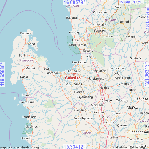
Calasiao GPS coordinates[2]
16° 0' 39.96" North, 120° 21' 36" East
| Map corner | latitude | longitude |
|---|---|---|
| Upper-left | 16.68579°, | 119.65688° |
| Center: | 16.0111°, | 120.36° |
| Lower-right: | 15.33412°, | 121.06313° |
| Map W x H: | 150.3×150.3 km | = 93.4×93.4mi |
| max Lat: | 20.78733° ⇑12.2% North |
| Calasiao: | 16.0111° |
| min Lat: | ⇓87.8% South 4.65442° |
| min Long | Calasiao | max Long |
| 117.04868° | 120.36° | 126.58417° |
| W 5.5%⇐ | ⇒94.5% E |
Elevation
Elevation of Calasiao is 9 m = 30 ft, and this is 78.9 m = 259 ft below average elevation for this country.
| Max E: |
2262 m = 7421 ft | 80.7% |
| Avg. | 87.9 m = 288 ft | |
| Calasiao | 9 m = 30 ft | |
Min E: |
-2 m = -7 ft | 19.3% |
See also: Philippines elevation on elevation.city.
Geographical zone
Calasiao is located in North Torrid zone (between Equator and Tropic of Cancer). Distance of this Northern Tropic circle is 825.7 km =513.1 mi to North.| Distance of | km | miles | from Calasiao |
|---|---|---|---|
| North Pole | 8226.8 | 5111.9 | to North |
| Arctic Circle | 5620.9 | 3492.7 | to North |
| Tropic Cancer | 825.7 | 513.1 | to North |
| Equator | 1780.3 | 1106.2 | to South |


Nearby cities:
15 places around Calasiao: (largest is in red/bold)
• Bolingit
5.9 km =3.7 mi,  190°
190°
• Bulog
7.2 km =4.5 mi,  141°
141°
• Camaley
6.5 km =4 mi,  256°
256°
• Canaoalan
7.1 km =4.4 mi,  286°
286°
• Dagupan
4.6 km =2.9 mi,  321°
321°
• Doyong
4.4 km =2.7 mi, 188°
• Gayaman
5.6 km =3.5 mi,  273°
273°
• Malabago
3.3 km =2.1 mi,  181°
181°
• Malanay
5.3 km =3.3 mi,  92°
92°
• Nagsaing
4.1 km =2.5 mi,  214°
214°
• Naguilayan
7.4 km =4.6 mi, 263°
• Quintong
7.4 km =4.6 mi, 213°
• Santa Barbara
4.7 km =2.9 mi,  104°
104°
• Sonquil
4.1 km =2.5 mi,  128°
128°
• Tandoc
6.6 km =4.1 mi, 209°
Sources, notices
• [Note1] Compared only with cities in Philippines existing in our database
• [Src1] Map data: © OpenStreetMap contributors (CC-BY-SA)
• [Src2] Other city data from geonames.org with taken over terms of usage.
• [Src3] Geographical zone / Annual Mean Temperature by Robert A. Rohde @ Wikipedia
