Nagsaing geodata
Nagsaing (Ilocos) is a populated place; located in Philippines in Asia/Manila (GMT+8) time zone. With population of 7,482 people, there are 832 cities with bigger population in this country. Compared to other cities in Philippines, 87.2% of cities are located further ↓South; 94.9% of cities are located further →East and 76.6% of cities have higher elevation than Nagsaing. Note1


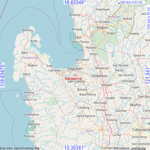
Nagsaing GPS coordinates[2]
15° 58' 50.484" North, 120° 20' 16.332" East
| Map corner | latitude | longitude |
|---|---|---|
| Upper-left | 16.65549°, | 119.63475° |
| Center: | 15.98069°, | 120.33787° |
| Lower-right: | 15.30361°, | 121.041° |
| Map W x H: | 150.3×150.3 km | = 93.4×93.4mi |
| max Lat: | 20.78733° ⇑12.8% North |
| Nagsaing: | 15.98069° |
| min Lat: | ⇓87.2% South 4.65442° |
| min Long | Nagsaing | max Long |
| 117.04868° | 120.33787° | 126.58417° |
| W 5.1%⇐ | ⇒94.9% E |
Elevation
Elevation of Nagsaing is 10 m = 33 ft, and this is 77.9 m = 256 ft below average elevation for this country.
| Max E: |
2262 m = 7421 ft | 76.6% |
| Avg. | 87.9 m = 288 ft | |
| Nagsaing | 10 m = 33 ft | |
Min E: |
-2 m = -7 ft | 23.4% |
See also: Philippines elevation on elevation.city.
Geographical zone
Nagsaing is located in North Torrid zone (between Equator and Tropic of Cancer). Distance of this Northern Tropic circle is 829 km =515.1 mi to North.| Distance of | km | miles | from Nagsaing |
|---|---|---|---|
| North Pole | 8230.2 | 5114 | to North |
| Arctic Circle | 5624.3 | 3494.8 | to North |
| Tropic Cancer | 829 | 515.1 | to North |
| Equator | 1776.9 | 1104.1 | to South |


Nearby cities:
15 places around Nagsaing: (largest is in red/bold)
• Balogo
6 km =3.7 mi,  280°
280°
• Bolingit
2.7 km =1.7 mi,  152°
152°
• Calasiao
4.1 km =2.5 mi,  34°
34°
• Calomboyan
5.3 km =3.3 mi,  224°
224°
• Camaley
4.3 km =2.7 mi,  295°
295°
• Canaoalan
7 km =4.3 mi,  320°
320°
• Doyong
2 km =1.2 mi,  118°
118°
• Gayaman
4.9 km =3 mi, 318°
• Malabago
2.3 km =1.4 mi,  87°
87°
• Malawa
6.9 km =4.3 mi,  248°
248°
• Naguilayan
5.6 km =3.5 mi, 296°
• Pangpang
5.6 km =3.5 mi,  213°
213°
• Quintong
3.3 km =2.1 mi, 211°
• Sonquil
5.7 km =3.5 mi,  81°
81°
• Tandoc
2.6 km =1.6 mi,  201°
201°
Sources, notices
• [Note1] Compared only with cities in Philippines existing in our database
• [Src1] Map data: © OpenStreetMap contributors (CC-BY-SA)
• [Src2] Other city data from geonames.org with taken over terms of usage.
• [Src3] Geographical zone / Annual Mean Temperature by Robert A. Rohde @ Wikipedia
