Talahiban I geodata
Talahiban I (Calabarzon) is a populated place; located in Philippines in Asia/Manila (GMT+8) time zone. With population of 3,385 people, there are 2152 cities with bigger population in this country. Compared to other cities in Philippines, 65.5% of cities are located further ↓South; 68.9% of cities are located further →East and 52.3% of cities have lower elevation than Talahiban I. Note1


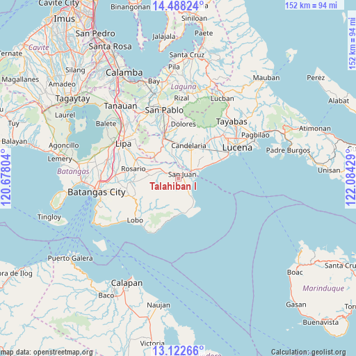
Talahiban I GPS coordinates[2]
13° 48' 23.22" North, 121° 22' 52.176" East
| Map corner | latitude | longitude |
|---|---|---|
| Upper-left | 14.48824°, | 120.67804° |
| Center: | 13.80645°, | 121.38116° |
| Lower-right: | 13.12266°, | 122.08429° |
| Map W x H: | 151.8×151.8 km | = 94.3×94.3mi |
| max Lat: | 20.78733° ⇑34.5% North |
| Talahiban I: | 13.80645° |
| min Lat: | ⇓65.5% South 4.65442° |
| min Long | Talahiban I | max Long |
| 117.04868° | 121.38116° | 126.58417° |
| W 31.1%⇐ | ⇒68.9% E |
Elevation
Elevation of Talahiban I is 25 m = 82 ft, and this is 62.9 m = 206 ft below average elevation for this country.
| Max E: |
2262 m = 7421 ft | 47.7% |
| Avg. | 87.9 m = 288 ft | |
| Talahiban I | 25 m = 82 ft | |
Min E: |
-2 m = -7 ft | 52.3% |
See also: Philippines elevation on elevation.city.
Geographical zone
Talahiban I is located in North Torrid zone (between Equator and Tropic of Cancer). Distance of this Northern Tropic circle is 1070.8 km =665.4 mi to North.| Distance of | km | miles | from Talahiban I |
|---|---|---|---|
| North Pole | 8471.9 | 5264.2 | to North |
| Arctic Circle | 5866 | 3645 | to North |
| Tropic Cancer | 1070.8 | 665.4 | to North |
| Equator | 1535.1 | 953.9 | to South |


Nearby cities:
15 places around Talahiban I: (largest is in red/bold)
• Cabay
7.2 km =4.5 mi,  358°
358°
• Libato
5.1 km =3.2 mi,  280°
280°
• Lipahan
4 km =2.5 mi,  33°
33°
• Macalamcam A
8 km =5 mi,  314°
314°
• Palahanan Uno
3.8 km =2.4 mi,  315°
315°
• Pinagsibaan
7.2 km =4.5 mi,  295°
295°
• Poctol
6.7 km =4.2 mi,  76°
76°
• Pulangbato
6 km =3.7 mi,  168°
168°
• Putingkahoy
6.4 km =4 mi,  294°
294°
• Quipot
3.5 km =2.2 mi,  150°
150°
• Sampiro
2.5 km =1.6 mi, 172°
• San Juan
3.6 km =2.2 mi, 31°
• Santa Catalina Norte
7.6 km =4.7 mi,  340°
340°
• Sico Uno
2.8 km =1.7 mi, 337°
• Tipaz
5.3 km =3.3 mi,  62°
62°
Sources, notices
• [Note1] Compared only with cities in Philippines existing in our database
• [Src1] Map data: © OpenStreetMap contributors (CC-BY-SA)
• [Src2] Other city data from geonames.org with taken over terms of usage.
• [Src3] Geographical zone / Annual Mean Temperature by Robert A. Rohde @ Wikipedia
