Lipahan geodata
Lipahan (Calabarzon) is a section of populated place; located in Philippines in Asia/Manila (GMT+8) time zone. With population of 3,403 people, there are 2129 cities with bigger population in this country. Compared to other cities in Philippines, 66.1% of cities are located further ↓South; 68.5% of cities are located further →East and 57.6% of cities have higher elevation than Lipahan. Note1


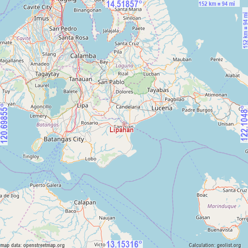
Lipahan GPS coordinates[2]
13° 50' 12.732" North, 121° 24' 6.012" East
| Map corner | latitude | longitude |
|---|---|---|
| Upper-left | 14.51857°, | 120.69855° |
| Center: | 13.83687°, | 121.40167° |
| Lower-right: | 13.15316°, | 122.1048° |
| Map W x H: | 151.8×151.8 km | = 94.3×94.3mi |
| max Lat: | 20.78733° ⇑33.9% North |
| Lipahan: | 13.83687° |
| min Lat: | ⇓66.1% South 4.65442° |
| min Long | Lipahan | max Long |
| 117.04868° | 121.40167° | 126.58417° |
| W 31.5%⇐ | ⇒68.5% E |
Elevation
Elevation of Lipahan is 18 m = 59 ft, and this is 69.9 m = 229 ft below average elevation for this country.
| Max E: |
2262 m = 7421 ft | 57.6% |
| Avg. | 87.9 m = 288 ft | |
| Lipahan | 18 m = 59 ft | |
Min E: |
-2 m = -7 ft | 42.4% |
See also: Philippines elevation on elevation.city.
Geographical zone
Lipahan is located in North Torrid zone (between Equator and Tropic of Cancer). Distance of this Northern Tropic circle is 1067.4 km =663.3 mi to North.| Distance of | km | miles | from Lipahan |
|---|---|---|---|
| North Pole | 8468.5 | 5262.1 | to North |
| Arctic Circle | 5862.7 | 3642.9 | to North |
| Tropic Cancer | 1067.4 | 663.3 | to North |
| Equator | 1538.5 | 956 | to South |


Nearby cities:
15 places around Lipahan: (largest is in red/bold)
• Cabay
4.4 km =2.7 mi,  328°
328°
• Libato
7.6 km =4.7 mi,  251°
251°
• Macalamcam A
8.2 km =5.1 mi,  285°
285°
• Palahanan Uno
4.9 km =3 mi,  262°
262°
• Pinagsibaan
8.7 km =5.4 mi,  268°
268°
• Poctol
4.7 km =2.9 mi,  112°
112°
• Putingkahoy
8 km =5 mi, 264°
• Quipot
6.4 km =4 mi,  184°
184°
• Sampiro
6.2 km =3.9 mi,  197°
197°
• San Juan
0.5 km =0.3 mi,  227°
227°
• Santa Catalina Norte
6.1 km =3.8 mi,  308°
308°
• Santa Catalina Sur
5.2 km =3.2 mi,  37°
37°
• Sico Uno
3.4 km =2.1 mi, 257°
• Talahiban I
4 km =2.5 mi,  213°
213°
• Tipaz
2.7 km =1.7 mi, 110°
Sources, notices
• [Note1] Compared only with cities in Philippines existing in our database
• [Src1] Map data: © OpenStreetMap contributors (CC-BY-SA)
• [Src2] Other city data from geonames.org with taken over terms of usage.
• [Src3] Geographical zone / Annual Mean Temperature by Robert A. Rohde @ Wikipedia
